
Rhine regulation (Alpine Rhine)
As Rhine Regulation (also Rhine correction applied to called) border between Austria and Switzerland took place river regulation of the Alpine Rhine referred to at the beginning of the 20th century. It served on the one hand to reduce the risk of flooding and on the other hand to reorganize the state border that ran along the former arms of the Rhine.
history

The oldest news of a flood of the Alpine Rhine comes from the year 1206. One of the worst occurred on September 28, 1868, when almost the entire Rhine valley from Sevelen to Lake Constance was under water. The Rhine dam broke in three places. The inhabitants of the villages along the Rhine helped each other for their own benefit by building dams in the river to control the current, the Schupfwuhren and Buckwuhren . In a bed 200 to 300 meters wide, accompanied on both sides by inland waterways and inland dams 500 to 1000 meters apart, the Alpine Rhine meandered through the Alpine Rhine Valley . It deposited debris it had carried with it and flooded its banks on average every three years. Between 1861 and 1881, the canton of St. Gallen, supported by the Swiss Federal Treasury, the Principality of Liechtenstein and the Austrian Empire, created a regular river bed between Landquart and Au . The swallowing capacity of the river bed was still insufficient, which is why the dams were increased again by 1890.
More than 30 streams still flowed into the Alpine Rhine below Landquart. In the event of flooding, these were dammed back and flooded. Therefore, in less than two years, from 1882 to 1884, the 20.8 km long Werdenberg inland canal was built , which takes all the side streams between Wartau and Rüthi and guides them into the Rhine. The Rheintaler inland canal was opened 20 years later and takes in all the side streams from Rüthi to Au. In 1910 the Vorarlberger Rheintalbinnenkanal was completed, which serves to drain the area between the catchment areas of Frutz and Dornbirner Ach . The almost 25 km long Liechtenstein Inland Canal was not completed until 1943.
State Treaty 1892

The treaty on the regulation of the Rhine concluded in 1892 between Austria-Hungary and Switzerland put an end to many flood disasters on the Alpine Rhine between Sargans and Lake Constance by shortening the course of the river by around ten kilometers with two punctures in order to increase the gradient and thus the thrust of the water and thereby avoid sediment deposits. The Gesellschaft Internationale Rheinregulierung (IRR) is the roof under which the two states Austria and Switzerland coordinated the construction and still regulate the maintenance of the dams today. It is based in Rorschach and has construction management in Lustenau, Austria and St. Gallen in Switzerland .
execution

After the contract was signed, the Fußacher pier to Lake Constance was opened in 1900 after a five-year construction period . After some delays caused by the First World War, the Rhine was diverted into its new river bed when the Diepoldsauer breakthrough occurred in 1923 . Since sedimentation of Fussach and Harder bay began, another treaty in 1924 closed to continue the regulation work, and more particularly to pre-stretch the river bed into the lake. Boulder deposits in the course of the river over the years led to the realization that the cross-section of the central channel was too large. In 1954 the third state treaty was therefore concluded to narrow the central channel, to change and increase the flood dams for a discharge rate of 3100 m³ / s and also to build the extension further into the lake. The flood event of 1987 with a water volume of 2650 m³ / s showed that the measures have proven their worth.
The Rhine bed is 60 to 70 meters wide and has flood dams on both sides with a distance of up to 260 meters. The strip between the flood dam and the low water bed is called the Rhine foreland . The foreland, mostly used as pasture, is only flooded for a short time during major floods, so that a path along the banks of the Rhine can sometimes lead along. Parts of the Rhine Cycle Route run in the foreland or on the flood dam.

Old Rhine and inland canals
The waters separated from the Rhine, which were created when the course of the river was straightened from Lake Constance to St. Margrethen and east of Diepoldsau , are called the Old Rhine . The waters that drain large parts of the Rhine Valley parallel to the Rhine were created as inland canals . The longest of them are the Werdenberger and Rheintaler inland canals on the Swiss side and the Vorarlberg Rheintal inland canals on the Austrian side. The Rheintaler inland canal was connected to the old Rhine , which was created by the Fußacher piercing . For its part, the Vorarlberg Rhine Valley Inner Canal was connected with the heavily corrected Dornbirner Ache , which now runs parallel to the New Rhine in a canal-like manner on its lower reaches . The Old Rhine , which was created by the Diepoldsauer breakthrough , became a stagnant body of water in which gravel was extracted for a long time . Today it is largely a nature reserve or a swimming lake . In Diepoldsau, a section was converted into a public lido .
Expansion of the Rhine
A change in the course of the Rhine in the existing watercourse is currently planned. This should create a higher level of flood security and an ecologically improved situation of the water body. See: Expansion of the Rhine (RHESI).
Railway of the international Rhine regulation
A railway with a gauge of 750 mm was built especially for the work of the Rhine regulation, the railway of the international Rhine regulation . After completing its original transport task, part of this route has been in operation as the Rheinschauen museum railway since 2008.

Steam locomotive in the service of the International Rhine Regulation, stationed in Lustenau

Line on the right bank of the Rhine near Hard
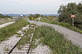
Level crossing at Hard shortly before the end of the line


See also
- Straightening of the Rhine on the Upper Rhine by Johann Gottfried Tulla and his successors between 1817 and 1876
- List of old Rhine waters
- International Alpine Rhine Government Commission
literature
- International Rhine Regulation (ed.): The Alpine Rhine and its regulation. International Rhine Regulation 1892–1992. 2nd edition, BuchsDruck, Rorschach 1993, ISBN 3-905222-65-5 .
Web links
- Homepage of the IRR *
- Interregio Alpenrhein-Bodensee-Hochrhein (information on economic cooperation in large aglomeration)
- Philipp Krapf, kk Baurath: International Rhine Regulation in Vorarlberg. : Allgemeine Bauzeitung , year 1900, p. 90 (online at ANNO ).
- Swisstopo, a topographical journey through time from 1850 to today
Individual evidence
- ^ Educational Council of the Canton of St. Gallen (Ed.): St.Gallerland . Kantonaler Lehrmittelverlag St.Gallen, 1982, The Rhine is banned, p. 256 ff .
- ^ Educational Council of the Canton of St. Gallen (Ed.): St.Gallerland . Kantonaler Lehrmittelverlag St.Gallen, 1982, The construction of the inland canals, p. 258, 259 .
- ^ Haidvogel, Gertrud: Keyword "Inner Canal" . In: Project leader: Brunhart, Arthur (Ed.): Historisches Lexikon des Fürstentums Liechtenstein . tape 1 . Chronos, Zurich, p. 101 .
- ↑ State Treaty of the Swiss Confederation with the Republic of Austria on the regulation of the Rhine from the mouth of the Ill to Lake Constance (SR 0.721.191.632)
- ^ State treaty between the Swiss Confederation and the Republic of Austria on the regulation of the Rhine from the mouth of the Ill to Lake Constance (SR 0.721.191.633)