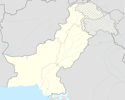
Shikarpur
|
Shikarpur شِکارپُور |
||
| State : |
|
|
| Province : | Are | |
| Coordinates : |
27 ° 57 ′ N , 68 ° 39 ′ E
|
|
| Residents : | 195,437 (2017 census) | |
| Time zone : |
PST ( UTC + 5 )
|
|
|
|
||
Shikarpur (Sindhi: شِڪارَپُور, Urdu: شِکارپُور) is the administrative seat of the Shikarpur district in Sindh Province in Pakistan . The city is located 29 km west of the Indus and is connected by road and rail to Sukkur (32 km southeast), Jacobabad and Larkana .
history
Shikarpur was a historic trading center established in 1617 along a caravan route. Due to its strategic location, the emerald green city became the seat of culture and trade of political and economic importance. It belonged to the British Empire between 1843 and 1947 . It received the status as a community in 1855. After Pakistan's independence, the Hindus of the minority emigrated to India (although not all), while the Muslim refugees from India also settled in Shikarpur.
Population development
| Census year | population |
|---|---|
| 1972 | 70,924 |
| 1981 | 88,138 |
| 1998 | 134,883 |
| 2017 | 195,437 |
economy
Shikarpur produces goods made of brass and other metals, cotton cloths, carpets and embroidery, among other things. The Grand Bazaar (covered in the summer heat) is famous between Turkey and South Asia. The Shikarpur area is a major area for growing rice, other crops are wheat, sugar cane and cotton. Sheep and goats are raised.
gallery
Individual evidence
- ↑ a b Kotri | Pakistan. Retrieved March 20, 2020 .
- ↑ Pakistan: Provinces and Major Cities - Population Statistics, Maps, Charts, Weather, and Web Information. Retrieved March 20, 2020 .


