Victory ferry
The victory ferry over the Sieg between Bergheim (a district of Troisdorf) and Geislar (a district of Bonn-Beuel) near its confluence with the Rhine is the only ferry across the river and one of the oldest one-man yaw ferries still in operation in Germany.
history
Between the banks of the Sieg, a low mountain range on the right bank of the Rhine in North Rhine-Westphalia and Rhineland-Palatinate , passenger ferries had been in use for centuries. The last remaining one-man passenger ferry connects the cities of Bonn ( Beuel district / Geislar district ) and Troisdorf (Bergheim district).
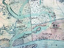
As part of a far-reaching straightening of the Victory Run, the “Bergheimer Fähre” ( “Berchemer Fahr” in the local dialect ) was moved to its current location in 1777 . Originally, the victory led directly past the place. From 1777 until secularization in 1804, the Vilich Abbey had ferry rights ; since then they have been in the hands of the state and are now perceived by the city of Troisdorf and the city of Bonn.
In the 18th and 19th centuries, the ferry was mostly operated by Bergheim fishermen. Their old Bergheim fishing brotherhood is still the sole owner of the fishing rights. They were inherited from father to son. The tradition of the around 400 - now scattered around the world - fishing brothers is preserved in the nearby Bergheim fishing museum.
ferry
The wooden barges originally used for ferry operations have now been replaced by modern vehicles made of metal. A modern ferry boat called " St. Adelheid " has been in use since August 2005 , the hull of which is made of double-walled aluminum. It can carry 20 people or about 10 people with bicycles. The ferry was built in the Lux shipyard in Mondorf , a few kilometers away , and financed by the city of Troisdorf and with the help of private sponsors. The dark green hull is marked on the starboard side with the lettering "Stadt Bezirk Beuel", on the port side it reads "Stadt Troisdorf".
The last previous model, a steel Gierponte (baptized “Sieglinde”), was in operation for 57 years and is now used as a planter on land . It can be viewed in front of the “Zur Siegfähre” excursion restaurant, which has been located on the Bergheim riverside since the 1920s.
The environmentally friendly, emission-free traffic connection works with the help of the flow force, which, together with a large stern rudder, ensures that the ferry glides along a wire rope stretched across the river. For this purpose, the boat is connected to the coulter rope with a rope (Giertau) and a roller attached to it. When the water level is low and the current is slower, the ferryman can intervene using a pole to support or change the angle of attack of the ferry .
The journey takes about 1½ minutes and costs 50 cents per adult or bicycle, 30 cents per child. The ferry service is usually maintained from Easter to the Day of German Unity from 9:30 a.m. to 8:00 p.m. and on Sundays from 9:00 a.m.
landscape
The Siegauen together with the rest of the alluvial forest have been designated as a nature reserve with an area of around 450 hectares since 1986. 240 species of birds, some of which are rare, were counted there. Their protection as well as the preservation of habitat as a natural flood plain is among other things the aim of the "Landscape Plan of the Sieg Mouth" drawn up by the Rhein-Sieg district .
Several cycle and footpaths lead along the Sieg. Parts of the Siegauen together with the estuary are known as the “Untere Sieg” recreation area. The main cycle path is part of the long-distance cycle path “ Erlebnisweg Rheinschiene ”.
Motor boats are not allowed to sail on the river. In the strictly limited recreation area of the nature reserve around the ferry docks, however, inflatable boats and air mattresses may be used; Swimming and diving in the river is permitted there at your own risk.
swell
- Siegfähre.de
- Ferryman, overtake ; The only one-man ferry in Germany is operated in Troisdorf-Bergheim (General-Anzeiger, Bonn)
- To the victory ferry , Kölnische Rundschau
- Speech by the Mayor of Troisdorf on the inauguration of the current ferry. (No longer available online.) Formerly in the original ; Retrieved January 25, 2016 . ( Page no longer available , search in web archives )
- St. Adelheid
- Maike Jansen: Made of aluminum, double-walled, unsinkable. General Anzeiger Bonn, August 15, 2005, accessed on January 19, 2014 .
Web links
Coordinates: 50 ° 45 ′ 55 ″ N , 7 ° 6 ′ 26 ″ E


