Sierra de los Tuxtlas

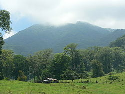
The Sierra de Los Tuxtlas (Tuxtla Mountains) is an isolated and comparatively small mountain range of volcanic origin on the Mexican Gulf coast .
etymology
The Nahuatl word Tuxtla comes from the Aztec Tochtlan , which means 'place of the rabbits'. The city coat of arms of San Andrés Tuxtla shows one of them.
geography
The mountain range extends in the Mexican state of Veracruz along the coast of the Gulf of Mexico at approximately 18 ° north latitude. Its peaks, which are up to 1700 m high, include the volcanoes Santa Marta (800 m) and San Martin Tuxtla (1690 m). The latter is a shield volcano , the summit of which is one kilometer in diameter, and the only volcano in the mountain range that was still active in recent times (1664 and 1793). The smaller volcanoes of the Sierra de Los Tuxtlas include the San Martin Pajapan (1160 m) and the Cerro El Vigía (1074 m). There are also countless smaller cinder cones scattered across the entire mountain range . The volcanoes of the Sierra de Los Tuxtlas are a good 250 km from the Transmexican Volcanic Belt and about 330 km from the Central American Volcanic Belt .
history
At the time of the Olmecs , the Sierra de Los Tuxtlas supplied those spherical basalt stones from which the colossal heads of La Venta , San Lorenzo Tenochtitlan and Tres Zapotes were made. While the other two centers of Olmec culture had long since perished, there is only evidence of uninterrupted settlement up to around 1000 AD in Tres Zapotes. In the middle of the 15th century, the area belonged to the Aztecs' sphere of influence ; around 1520/25 the Spanish conquistadors also came to this area and founded a. a. the cities of Santiago Tuxtla and San Andrés Tuxtla , which belonged to the dominion of Hernán Cortés , the Marqués del Valle de Oaxaca .
Los Tuxtlas nature reserve
The flanks of the volcanoes San Martin Tuxtla and Santa Marta are covered with neotropical vegetation in the upper area . Further down, the forests have been cut down to make pastures for livestock farming and nature continues to be at risk from the region's rapidly growing population. In order to prevent greater damage, an area of around 1551 km² was declared a Reserva de la Biosfera by the Mexican government in 1998 and is therefore under nature protection. This includes both the Reserva Biosfera Volcan de San Martin , which stretches along the coast from Roca Partida in the northwest to just before La Barra in the southeast, and the Reserva Ecológica Nanciyaga , which includes the third largest lake in Mexico with Lake Catemaco . The sanctuary includes mangrove swamps and the Tehuantepec rainforest . The area is also famous for local healers ( curanderos or brujos ) who use natural remedies and rituals to treat those seeking help.
literature
- Yarza de la Torre, Esperanza: Volcanes de México , Aguilar, 1971
Web links
- Los Tuxtlas Nature Park - Photos + Info (English)
- Sierra de los Tuxtlas - Maps, photos + information (English)
- Sierra de los Tuxtlas - Maps, photos + information (English)
- Sierra de los Tuxtlas, volcanism - photos + information (English)
Remarks
- ↑ The altitude information mentioned varies depending on the source
Coordinates: 18 ° 33 ′ N , 95 ° 12 ′ W
