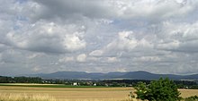
Slanské vrchy
Coordinates: 48 ° 45 ' N , 21 ° 30' E

Slanské vrchy (previously also Prešovské hory ; German Eperieser / Sovarer Gebirge , Hungarian Szalánci-hegység ) is a mountain range in eastern Slovakia and takes its name from the town Slanec in the southern part .
The approximately 50 kilometers long and 16 kilometers wide area stretches southeast of the town of Prešov between the Košická kotlina and the East Slovak Plain in a north-south direction and is flanked by the Topľa and Oľšava / Torysa rivers . The mountains are on average 800–1000 meters high (highest point Šimonka at 1092 meters), wooded, have some mineral springs and various mineral resources such as gold, silver, antimony or the famous Dubník opals .
Some passes through the mountains are z. B. the Herľany Pass and the Dargov Pass .
See also
- Tokaj Mountains
- Northern Hungarian Central Mountains (Mátra-Slanec area)
Web links
