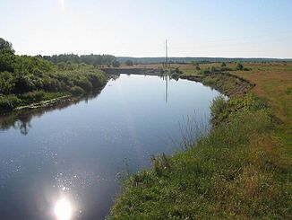
Snow (river)
|
Snow Снов |
||
|
Snow at Sedniw |
||
| Data | ||
| location |
Bryansk Oblast ( Russia ), Chernihiv Oblast ( Ukraine ) |
|
| River system | Dnepr | |
| Drain over | Desna → Dnepr → Black Sea | |
| source | southeast of Novosybkow 52 ° 28 ′ 6 ″ N , 32 ° 4 ′ 42 ″ E |
|
| muzzle | at Brussyliw in Desna coordinates: 51 ° 31 ′ 49 ″ N , 31 ° 31 ′ 50 ″ E 51 ° 31 ′ 49 ″ N , 31 ° 31 ′ 50 ″ E
|
|
| length | 253 km | |
| Catchment area | 8700 km² | |
| Outflow location: 82 km above the mouth |
MQ |
24 m³ / s |
|
Location of the Snow (Снов) in the catchment area of the Desna |
||
The Snow ( Russian and Ukrainian Снов ) is a right tributary of the Desna . It rises a few kilometers southeast of the Russian city of Novosybkow and flows into the Desna in the Ukrainian Oblast Chernihiw near Brussyliw in Polesia . It has a length of 253 km and a catchment area of 8,700 km². In the upper course , where it forms the Russian-Ukrainian border in sections, the snow is between four and 14 m wide, while in the lower course it widens to 20 to 40 m. The river valley is between 1.5 and 4 km wide.
In winter, the snow is usually frozen over from November or December to April. Its water is used for irrigation in the lower reaches .
Web links
Commons : Snow - collection of images, videos and audio files
Individual evidence
- ↑ a b c Article Snow in the Great Soviet Encyclopedia (BSE) , 3rd edition 1969–1978 (Russian)

