Soira
| Soira | ||
|---|---|---|
| height | 3018 m | |
| location | Eritrea / East Africa | |
| Mountains | Great African rift valley | |
| Coordinates | 14 ° 43 '48 " N , 39 ° 39' 37" E | |
|
|
||
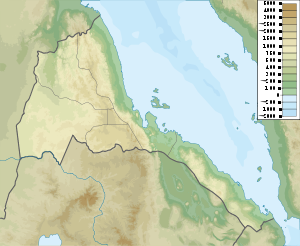
The Soira (also: Amba Soira ) is the second highest mountain in Eritrea and is only surpassed by the Dega . It is located about 100 km southeast of the capital Asmara in a poorly developed area of the high plateau, which is formed here by the western branch of the Great African Rift Valley.
literature
- Alain Gascon: Amba Soyra . In: Siegbert Uhlig (Ed.): Encyclopaedia Aethiopica , Volume 1. 2003, ISBN 3-447-04746-1 , p. 222. ( Online )
Web links
- Soira on Peakbagger.com (English)
