South Crofty Mine
| South Crofty Mine | |||
|---|---|---|---|
| General information about the mine | |||
| Robinson Shaft, South Crofty Mine | |||
| other names | Penhellick Vean, East Wheal Crofty, South Wheal Crofty | ||
| Information about the mining company | |||
| Start of operation | 1592 | ||
| End of operation | 1998 | ||
| Funded raw materials | |||
| Degradation of | Tin / copper | ||
| Degradation of | copper | ||
| Geographical location | |||
| Coordinates | 50 ° 13 '21.8 " N , 5 ° 16' 28.7" W | ||
|
|||
| Location | pool | ||
| local community | pool | ||
| county | Cornwall | ||
| Country | United Kingdom | ||
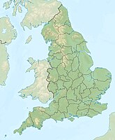
The South Crofty is a tin - and copper - mine in Pool , Cornwall between Nelspruit and Redruth . It includes almost two and a half miles mines up to 910 m depth . Over 40 corridors were exploited. After more than 400 years of operation, it was closed in May 1998 due to unprofitable. Investigations have been taking place since 2012 for a possible resumption of funding.
history
The South Crofty Mine is an old tin mine . For several centuries, copper was mined in the shallower area instead of the deeper tin mineralization . There is evidence of mining rather than open pit mining for 1592 and mining was well established by the mid-17th century. During this time, part of the mine now known as South Crofty was called Penhellick Vean. The first really important developments came in 1710 when Francis Bassett received a lease for Penhellick Vean and construction of a water solution gallery began. Over the next twenty years, the shallow mine, which was less than 40 meters or 130 feet deep, produced copper of great value and made a fortune for the Bassett family. After the numerous copper mines in Anglesey opened between 1770 and 1780, most of the mines in South Crofty closed.
19th century
After 1822, the copper ore was mined at a new mine, East Wheal Crofty , in the area that included Penhellick Vean in 1833. Mining depth was now 80 meters (260 feet) or more, and significant investments were made in the 1830s to improve the mine, including a rail link, making East Wheal Crofty a model mine in 1842 . This situation did not last, however, and in 1863 part of the property was up for sale. The rest of the mine, now at least 210 meters (690 feet) deep, was renamed South Wheal Crofty , which - except for the deletion of "Wheal" - is the name to this day.
The mine was now exposed to far-reaching changes. In the 1860s, South Wheal Crofty was still almost entirely a copper mine, but after significant investments in new machinery in 1873, the mine became - at least financially - dependent on tin. Copper remained significant until 1880 when the shallow reserves were depleted. The mine was now operated at 260 fathoms (1,600 ft, 480 m) depth where only tin was found. The collapse in the price of tin affected South Wheal Crofty both directly through reduced revenues and indirectly through increased water management costs because the neighboring mines had been closed. In February 1896, mining was postponed and the mine was flooded.
Further funding was raised in 1899 and South Crofty gradually reopened, and the neighboring New Cooks Kitchen mine was purchased. It was made on mine improvements and the Robinson bay in 1903 weiterverteuft . The mine returned to profitability and a new era began with the formation of South Crofty Limited in 1906 .
literature
- JA Buckley: History of South Crofty Mine . 2nd Edition. Truran, 1997, ISBN 978-1-85022-115-9 .
Web links
- Western United Mines Ltd. Cornwall Council, accessed June 19, 2013 .
- File inventory. Retrieved June 19, 2013 .
- South Crofty Mine Main Site 1. Cornish mine images, accessed June 19, 2013 .
- South Crofty Mine Underground 1. Cornish mine images, accessed June 19, 2013 (English, underground images).
Individual evidence
- ^ South Crofty tin mine exploration 'could stop'. BBC, May 30, 2013, accessed June 19, 2013 .

