
South London
.svg)
South London is the southern area of London , England .
Two criteria are used to determine whether a borough is part of South London. Either it is south of the Thames or the postcode belongs to the number range of South London (SE = Southeast or SW = Southwest). Boroughs that meet both criteria generally belong to South London. The districts that only meet one criterion are decided on a case-by-case basis.
Definition of the border commission

The Boundary Commission determines that South London includes the London Boroughs of Bexley , Bromley , Croydon , Greenwich , Kingston , Lambeth , Lewisham , Merton , Richmond , Southwark , Sutton and Wandsworth .
The Boundary Commission was established in 1986 to define the constituency boundaries for elections to the British Parliament . The commission determined that South London consists of all parts of the city south of the Thames.
The commission grouped districts with similar interests, Bexley with Greenwich, Lewisham with Bromley, Lambeth with Southwark, and Kingston with Richmond. For this reason, Richmond was also divided into South London, although it is on both sides of the Thames.
Definition of the London Plan

The London Plan distinguishes South East London with the boroughs of Bexley, Greenwich, Lewisham, Bromley and Southwark, and South West London with the boroughs of Croydon, Kingston, Lambeth, Merton, Richmond, Sutton and Wandsworth. South East and South West London together correspond exactly to South London as determined by the Border Commission.
The sub-regions were established to promote the growth and development of London, overseen by the Mayor of London . The plan describes the sub-regions as a flexible concept that should develop and enforce a strategic plan to implement the London Plan. South London was divided into two sub-regions: South East and South West, each with its own development plan.
1.7 million people live in South West. It has 730,000 jobs and is one of the healthiest sub-regions in London. In contrast, South East has the lowest population with 1.3 million inhabitants. With 500,000 jobs, there are also the fewest jobs there. For this reason, only South East was included in a national economic development program, the Thames Gateway, as well as in the promotion for Central London.
Colloquial use
Deviating from the official definitions, South London includes the areas south of Central London and the River Thames. This area spans parts of Central, South East and South West London. Some of these areas belong to the postal code areas SE and SW. The following list shows the boroughs that are wholly or partly in this area. The list shows the postal code, the direction from the symbolic center of London, Charing Cross, the sub-region and the constituency for the election of the London Assembly:
| London Borough | ZIP code area | Charing Cross | Sub-region | London Assembly | |
|---|---|---|---|---|---|
| Bexley | DA, SE | East-southeast | South east | Bexley and Bromley | |
| Bromley | BR, SE | Southeast | South east | Bexley and Bromley | |
| Croydon | CR, SE, SW | south | South west | Croydon and Sutton | |
| Greenwich | SE, DA, BR | east south-east | South east | Greenwich and Lewisham | |
| Kingston | KT, SW | southwest | South west | South west | |
| Lambeth | SE, SW | south | South west | Lambeth and Southwark | |
| Lewisham | SE, BR | southeast | South east | Greenwich and Lewisham | |
| Merton | CR, KT, SM, SW | southwest | South west | Merton and Wandsworth | |
| Richmond | SW, TW | southwest | South west | South west | |
| Southwark | SE | south | South east | Lambeth and Southwark | |
| Sutton | SM | southwest | South west | Croydon and Sutton | |
| Wandsworth | SW | southwest | South west | Merton and Wandsworth | |
gallery

Globe Theater , Southwark
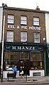
Eel & Pie House, Peckham

Peckham Library

Aylesbury Estate, Walworth

Southwark Cathedral

Clapham Common underground station

The Oval, Kennington

MI6 headquarters, Vauxhall
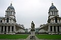
Greenwich Naval College
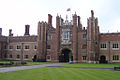
Hampton Court Palace


Individual evidence
- ^ Boundary Commission for England - South London Boroughs
- ^ Greater London Authority - Draft Further Alterations to the London Plan
- ↑ Archived copy ( Memento of the original from July 13, 2009 in the Internet Archive ) Info: The archive link was inserted automatically and has not yet been checked. Please check the original and archive link according to the instructions and then remove this notice.
- ↑ Archived copy ( memento of the original dated January 30, 2009 in the Internet Archive ) Info: The archive link was inserted automatically and has not yet been checked. Please check the original and archive link according to the instructions and then remove this notice.
- ^ London Assembly - London Assembly Constituency Information . Retrieved February 22, 2008.
Coordinates: 51 ° 26 ′ N , 0 ° 5 ′ W