
London Borough of Sutton
| London Borough of Sutton | |
|---|---|
  |
|
| status | London Borough |
| region | Greater London |
| Administrative headquarters | Sutton |
| surface | 43.85 km² |
| Residents | 204,525 |
| was standing | June 30, 2018 |
| ONS code | 00BF |
| Website | www.sutton.gov.uk |
The London Borough of Sutton [ ˈsʌtn̩ ] is a borough of London . It is in the south of the city. When the Greater London Administrative Region was founded in 1965, it emerged from the Municipal Borough of Sutton and Cheam , the Municipal Borough of Beddington and Wallington and the Carshalton Urban District in the county of Surrey . The population in 2008 was composed of 84.8% white, 6.5% Asian, 3.8% black and 0.9% Chinese. Minden and the Berlin district of Charlottenburg-Wilmersdorf are twin cities.
Districts
- Beddington
- Beddington Corner
- Belmont (Sutton)
- Benhilton
- Carshalton
- Carshalton Beeches
- Carshalton on the Hill
- Cheam
- Hackbridge
- North Cheam
- Rosehill
- St. Helier
- Sutton
- The Wrythe
- Wallington
- Worcester Park

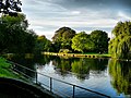
Leonie Bridge, Grove Park

Grove Park

Oaks Park

Mayfield lavender fields

Manor Park
Beddington Park

Butter Hill


Personalities
- Martin Adams (* 1956), darts player
- Harry Aikines-Aryeetey (* 1988), track and field athlete
- Keith Ballisat (1928–1996), racing car driver
- Jeff Beck (* 1944), guitarist
- Johnny Borrell (born 1980), singer
- Quentin Crisp (1908–1999), dandy, eccentric and gay icon
- Jack Draper (* 2001), tennis player
- Paul Greengrass (* 1955), director and author
- David Hunt (1960–2015), racing driver
- Ronald Jenkins (1907–1975), engineer
- Phyllis King (1905-2006), tennis player
- Peter Ladefoged (1925-2006), phonetician
- Peter Manley (* 1962), darts player
- Robbie McIntosh (born 1957), rock guitarist
- Rebecca Romero (* 1980), cyclist
- Erick Rowsell (* 1990), cyclist
- Joanna Rowsell (* 1988), cyclist
- Ruth Wynne-Davies (1926–2012), orthopedist
Web links
Commons : London Borough of Sutton - collection of images, videos and audio files
- Sutton Borough Council (county council)
Individual evidence
- ↑ Mid 2018 Estimates of the population for the UK, England and Wales, Scotland and Northern Ireland
- ^ ONS mid-2007 Ethnic Group Population Estimates. (PDF, 89 KB) (No longer available online.) Greater London Authority, October 2009, archived from the original on July 19, 2011 ; accessed on May 23, 2011 (English). Info: The archive link was inserted automatically and has not yet been checked. Please check the original and archive link according to the instructions and then remove this notice.
- ↑ There are no articles of their own on the respective districts, only forwarding here.
Coordinates: 51 ° 22 ′ N , 0 ° 12 ′ W