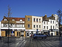
London Borough of Enfield
| London Borough of Enfield | |
|---|---|
| status | London Borough |
| region | Greater London |
| Administrative headquarters | Enfield Town |
| surface | 82.20 km² |
| Residents | 333,869 |
| was standing | June 30, 2018 |
| ONS code | 00AK |
| Website | www.enfield.gov.uk |
The London Borough of Enfield [ ˈɛnfiːld ] is the northernmost borough of London .
Districts
- Arnos Grove
- Bowes Park
- Brimsdown
- Bulls Cross
- Bush Hill Park
- Clay Hill
- Cockfosters
- Crews Hill
- Edmonton
- Enfield Chase
- Enfield Highway
- Enfield Island Village
- Enfield Lock
- Enfield Town
- Enfield Wash
- Forty Hill
- Freezywater
- Grange Park
- Hadley Wood
- New Southgate
- Oakwood
- Palmers Green
- Ponders End
- Southgate
- Winchmore Hill
- World's End (Enfield)
history
When the Greater London Administrative Region was established in 1965, it emerged from the Municipal Borough of Southgate , the Municipal Borough of Enfield and the Municipal Borough of Edmonton in Middlesex County .
The population in 2008 was composed of 70.9% white, 9.2% Asian, 13.5% black and 1.1% Chinese.
There is a partnership with the German city of Gladbeck and the Austrian city of Schwechat .
economy
Enfield has a long history of arms manufacturing , most notably through the Royal Small Arms Factory . The Lee-Enfield rifle in caliber .303 was the orderly rifle of the British Army until 1957 , and is still used in some cases today. Other small arms made locally were the Bren and Sten machine guns , with the "-en" in the name indicating Enfield manufacture.
The world's first semiconductor color televisions were manufactured by Ferguson in their former Enfield facility. The first industrially manufactured dishwasher was manufactured in the now closed Hotpoint factory in Enfield.
The world's first automated teller machine (ATM) went into operation in the local branch of Barclays Bank in 1967 .
A typical Art Deco factory building with a Grade II listing is on Southbury Road. The Ripaults Factory was located in it ; Travis Perkins' offices are located here today .
Museums and institutions
Town twinning
Enfield is partnered with
- Courbevoie (Haute-Seine department), France
- Gladbeck (North Rhine-Westphalia), Germany
- Halandri (Attica Region), Greece
- Sariyer (Istanbul Province), Turkey
Personalities
- Gladys Aylward (1902-1970), missionary
- Joseph Bazalgette (1819-1891), civil engineer
- Dudley Benjafield (1887–1957), doctor and racing car driver
- Charlotte Dujardin (* 1985), dressage rider
- Neil Etheridge (* 1990), soccer goalkeeper
- Michael Garrick (1933–2011), jazz keyboardist and composer
- Anthony Giddens (* 1938), sociologist
- Florence Green (1901–2012), World War I veteran
- Terry Harrison (born 1955), paleoanthropologist
- Brian Hart (1936–2014), racing driver and engine developer
- Brian Harvey (born 1974), singer
- Tony Jarrett (born 1968), track and field athlete
- David Jason (born 1940), actor
- Ralph Kemplen (1912-2004), film editor
- Neil Kilkenny (born 1985), football player
- Dave Murray (born 1956), guitarist
- Josh Onomah (born 1997), soccer player
- Patsy Rowlands (1931-2005), actress
- Jay Simpson (1988), football player
- Pete Way (1951-2020), bassist
- Amy Winehouse (1983-2011), jazz singer
Web links
- Enfield Borough Council (district administration)
Individual evidence
- ↑ Mid 2018 Estimates of the population for the UK, England and Wales, Scotland and Northern Ireland
- ^ ONS mid-2007 Ethnic Group Population Estimates. (PDF, 89 KB) (No longer available online.) Greater London Authority, October 2009, archived from the original on July 19, 2011 ; accessed on May 23, 2011 (English). Info: The archive link was inserted automatically and has not yet been checked. Please check the original and archive link according to the instructions and then remove this notice.
- ↑ Historic England: RIPAULTS FACTORY, Non Civil Parish - 1079486- Historic England .
Coordinates: 51 ° 39 ′ N , 0 ° 5 ′ W


