St. Simons
|
|
This article was on the basis of substantive defects quality assurance side of the project USA entered. Help bring the quality of this article to an acceptable level and take part in the discussion ! A closer description on the resolving issues is missing. |
| St. Simons | ||
|---|---|---|
|
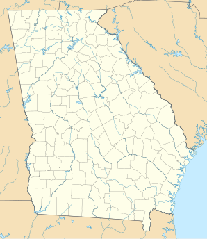
Location in Georgia
|
||
| Basic data | ||
| State : | United States | |
| State : | Georgia | |
| County : | Glynn County | |
| Coordinates : | 31 ° 10 ′ N , 81 ° 23 ′ W | |
| Residents : | 13,381 (as of: 2000) | |
| Population density : | 289.6 inhabitants per km 2 | |
| Area : | 46.2 km 2 (approx. 18 mi 2 ) | |
| Website : | www.glynncounty.org | |
St. Simons is a small town on St. Simons Island in Glynn County , Georgia , United States. The census-designated place (CDP) is part of the Brunswick Metropolitan Statistical Area and had 13,381 inhabitants at the 2000 census . It has an area of 46.2 km².
Fort Frederica , now Fort Frederica National Monument , is located on the island. The facility dates from the British period in the Province of Georgia and is now in ruins.

