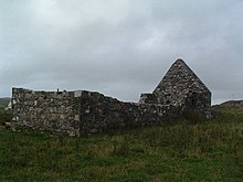
St Ciaran's Chapel
St. Ciaran's Chapel , also called St Ciaron's Chapel or Gaelic Cill Chiarain, is a ruined church in the small scattered settlement Kilchiaran near the west coast of the Rhinns of Islay peninsula on the Scottish Hebridean island of Islay . A former classification in the Scottish monuments lists in category B has now been lifted. Furthermore, the building is classified as a Scheduled Monument .
history
The exact time when the late medieval church was built is not known. Experts estimate the construction to be in the early 13th century. St. Ciaran's Chapel is believed to have been a subsidiary church of Kilchoman Church in Parish Kilchoman . There is no evidence of an independent Parish Kilchiaran . In a listing of churches on Islay from the late 17th century, St. Ciaran's Chapel is listed and may have been in use at that time. In any case, by 1794 it had already been abandoned and the roof collapsed. The church is named after Saint Kiaran and was the namesake for the surrounding village of Kilchiaran .
description
The external dimensions of the chapel are approximately 16 × 6.5 m 2 . The masonry is about 70 cm thick and made of quarry stone. At the beginning of the 1970s, only the east gable reached its original height, while mostly only remnants of less than a meter in height were preserved of the rest of the masonry. The chapel was entered through an entrance at the western end of the north side. The sanctuary at the eastern end was raised by about 60 cm and was accessible via two central steps, but also had its own entrance door in the south wall. Little is known about the number and location of windows, as these areas had recently fallen into complete disrepair. In a photograph from 1925, the remains of a window opening on the north side of the chancel can be seen.
1972–1973 parts of the church were rebuilt. Here, parts of a window opening were also restored, which should correspond to the model in the photograph from 1925. In addition to parts of the outer walls, the altar was also reconstructed on its old foundation. In the south-west of the interior a broken, slate baptismal font was rebuilt on a new base. It measures 46 cm with a depth of 24 cm and probably dates from the late Middle Ages.
Finds
Several cross plates were found in the church building . The oldest are probably from the 14th – 15th centuries. Century, the youngest from the 15th to early 16th centuries. A cross stone about 30 cm high, which was seen in a niche in the east wall in 1925, can no longer be found today. It can no longer be clarified to what extent it was a gravestone or a former decorative finial of the gable.
graveyard
To the east of the chancel, a cemetery was attached directly to the chapel. The area of 60 × 37 m 2 defined today is probably only a part of the area that was previously used. In the northwest, parts of the site may have been washed away by river erosion. In the south, today's road leads over the cemetery grounds, which could also have destroyed areas. In addition, a path that is now abandoned once crossed the area. The remains of five similar buildings measuring 9 × 5.5 m 2 were found on the northern boundary . These could come from the same time as the church was built and could be houses from a past settlement at this location.
Individual evidence
- ↑ a b c d e f g Entry on St Ciaran's Chapel in Canmore, the database of Historic Environment Scotland (English)
- ↑ a b Listed Building - Entry . In: Historic Scotland .
- ↑ Scheduled Monument - Entry . In: Historic Scotland .
Web links
Coordinates: 55 ° 45 ′ 12.2 " N , 6 ° 27 ′ 25.2" W.


