Pirna city bridge
Coordinates: 50 ° 57 ′ 55 ″ N , 13 ° 56 ′ 4 ″ E
| S 164 Pirna city bridge | ||
|---|---|---|
| Southeast view | ||
| Convicted |
State road 164 , Kamenz – Pirna railway line |
|
| Subjugated | Elbe , km 34.34 | |
| place | Pirna | |
| construction | Arch bridge | |
| overall length | 295.45 m | |
| width | 21.75 m | |
| Longest span | 36.2 m | |
| start of building | 1872 | |
| completion | 1875 | |
| location | ||
|
|
||
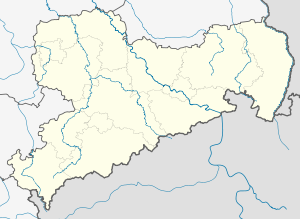
The Pirna City Bridge is a 295.45 m long Elbe bridge in Pirna from 1875. As a combined road and railway bridge , the stone arch bridge crosses State Road 164 and the Kamenz – Pirna railway line (km 45.65) and connects the Elbe at km 34.34 Central Pirnaer Westvorstadt with the northern part of Copitz . To distinguish it from the Sachsenbrücke , which was completed in 1999 , the bridge was given the name "Stadtbrücke" by the city of Pirna.
history
In Pirna, the Elbe was crossed at a ford in the Middle Ages. The city's first attempt to build a solid structure, a wooden bridge, over the Elbe is documented in 1563. He failed because of the funding. The next plans for a chain bridge were made in 1828 and were also not implemented because of the high costs. Only the construction of a connecting line between the Elbe Valley Railway and the Görlitz – Dresden line made it possible to build the desired Elbe bridge. The structure, a combined two-track railway and two-lane road overpass (with two narrow sidewalks), was built as a sandstone arch bridge based on designs by the Dresden hydraulic engineering inspector Hofmann. The foundation stone was laid on December 4, 1872, the keystone was laid on November 24, 1874, and the inauguration of the project, which cost approximately 2.15 million marks, followed on October 2, 1875.
In 1928, the carriageway and the footpath were widened from 5.8 m to 7 m and from 1.7 m to 3 m by installing a cantilevered reinforced concrete slab in order to take account of the growing volume of traffic. During the Second World War , on April 19, 1945, the bridge was so badly damaged in an attack by the US Air Force that it was unusable. The demolition of the already damaged bridge, prepared by the Wehrmacht, was prevented on May 8, 1945 by the bridge commander Rudolf Seidel, who had the ignition cables cut when the Soviet troops approached. In September 1945 the destroyed bridge field could be spanned with a makeshift bridge from the company Kelle & Hildebrandt . The reconstruction lasted almost unchanged until 1948. Due to reparations payments, a track was dismantled.
In the decades that followed, the necessary maintenance work was only inadequately carried out, so that the state of construction of the bridge steadily deteriorated. The upstream footpath had to be closed in 1989 for safety reasons. Comprehensive repairs were only carried out between 1992 and 1996. The railway line was finally reduced to one track.
construction
The bridge geometry in the floor plan is determined by the railway line. In the bridge area from Copitzer Ufer, it is curved for the first 109 m with a radius of 500 m, for the last 46 m with a radius of 250 m, with a straight section in between.
The bridge structure has nine circular segment arcs, four of which are stream openings on the Pirna river bank. The lengths of the two abutments, eight pillars and the clear arch widths in the bridge axis are 5.0 m + 16.0 m + 4.87 m + 20.0 m + 4.95 m + 24.0 m + 5.02 m + 30.0 m + 7.32 m + 30.0 m + 4.5 m + 30.0 m + 4.5 m + 30.0 m + 7.0 m + 30.0 m + 5.29 m + 30.0 m + 7.0 m, which gives a total length of 295.45 m. The pillars in the curved plan areas of the bridge are conical in plan , which means that the transom lines run parallel.
The sandstone arches have a thickness of 1.5 m in the transom and 1.25 m in the apex, the arch width is 16.0 m. The bridge arch 7 was rebuilt with reinforced concrete after its destruction in the Second World War and the damaged arches 6, 8 and 9 were repaired. The river piers are built on wooden piles, the others have a flat foundation.
The reinforced concrete deck slab cantilevered on both sides by up to 3.0 m was installed in 1928 and replaced during repairs in the 1990s. It can move in the longitudinal direction of the bridge in the area of the arch apex through the installation of expansion joints and plain bearings.
literature
- Axel Michalk: The Elbe Bridge in Pirna. In: Messages from the Saxon Homeland Security Association. Issue 1, 1992, ISSN 0941-1151 , pp. 20-24.
- Hans-Dieter Pfeiffer, Joachim Schmiedel: Elbe Bridge Pirna. In: Federal Ministry for Transport, Building and Housing (Hrsg.): Stone bridges in Germany. Volume 2: Berlin, Brandenburg, Mecklenburg-Western Pomerania, Saxony-Anhalt, Saxony, Thuringia. Verlag Bau + Technik, Düsseldorf 1999, ISBN 3-7640-0389-8 , pp. 182-186.
- City administration Pirna (ed.): The Elbe bridge Pirna. Construction - widening - reconstruction - renovation. From the beginning to the present. City book publisher W + I, Senftenberg 1994.
Web links
Individual evidence
- ^ The last order , Sächsische Zeitung (Pirna edition) of May 4, 2018
| upstream | Bridges over the Elbe | downstream |
| Carolabrücke (Bad Schandau) | Pirna city bridge |
Sachsenbrücke (Pirna) |


