Steinhatchee River
| Steinhatchee River | ||
|
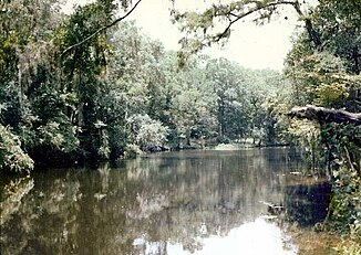
On the Steinhatchee River, about 8 km above the mouth |
||
| Data | ||
| location | Florida , United States | |
| River system | Steinhatchee River | |
| source | In Mallory Swamp south of Mayo, 29 ° 59 ′ 12 ″ N , 83 ° 13 ′ 32 ″ W |
|
| muzzle | In the Gulf of Mexico coordinates: 29 ° 40 ′ 1 ″ N , 83 ° 24 ′ 41 ″ W 29 ° 40 ′ 1 ″ N , 83 ° 24 ′ 41 ″ W |
|
| Mouth height |
0 m
|
|
| length | 55.5 km | |
| Catchment area | 1520 km² | |
|
On the Steinhatchee River |
||
The Steinhatchee River is a 55.5 km long river in Big Bend of the state of Florida in the southeastern United States . Historic names of the river are Hittenhatchee , Esteenhatchee, and Isteenhatchee .
geography
The river has its source in Mallory Swamp about 9 km south-southwest of Mayo in Lafayette County . Flowing south-southwest, the river crosses the border between Lafayette County and Dixie County . A few kilometers downstream, the Steinhatchee River crosses the border between Dixie County and Taylor County twice and then forms it to the mouth. To the west of Steinhatchee , the river flows into the Gulf of Mexico . The catchment area of the river covers an area of 1520 km².
The only places directly on the river are Steinhatchee and Jena near the river mouth. The river is not developed and is only used for recreation and use as a natural harbor for the landing of local fishing. About 1.5 km of the river runs underground, roughly where US Highway 19 crosses the river.
About 13 km above the estuary is the Steinhatchee Falls , where the river falls a few decimeters.
Individual evidence
- ^ US Geological Survey.

