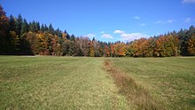
Stone marker brook
|
Steinmarker Bach (upper course: Krebsbach ) |
||
|
The Steinmarker Bach in Steinmark at the old washing area |
||
| Data | ||
| Water code | DE : 24564 | |
| location |
Spessart
|
|
| River system | Rhine | |
| Drain over | Wachenbach → Hafenlohr → Main → Rhine → North Sea | |
| source | north of Straßlücke 49 ° 53 ′ 16 ″ N , 9 ° 29 ′ 34 ″ E |
|
| Source height | 424 m above sea level NHN | |
| confluence | with the Esselbach to the Wachenbach Coordinates: 49 ° 51 '28 " N , 9 ° 32' 34" E 49 ° 51 '28 " N , 9 ° 32' 34" E |
|
| Mouth height | 245 m above sea level NHN | |
| Height difference | 179 m | |
| Bottom slope | 31 ‰ | |
| length | 5.7 km | |
| Catchment area | 6.5 km² | |
|
The Steinmarker Bach merges with the Esselbach (back right) to form the Wachenbach |
||
The Steinmarker Bach is the left source brook of the Wachenbach in the Main-Spessart district in the Bavarian Spessart .
geography
course

The Steinmarker Bach rises as Krebsbach or next brook north of Straßlücke . It is fed by the neighbor well shortly after its source and runs in a south-easterly direction. In Steinmarkskopf led to 1866 a ford through the stream. Since it was very muddy and the wagons got stuck frequently, a dam and a bridge had to be built on both sides. In 1837 the community had a washing area built there, where laundry and sacks of potatoes were cleaned until the 1960s . To the southeast of the village, it joins the Salzbachbrücke as a stone marker brook from the left with the Esselbach to the Wachenbach .
Hafenlohr river system
See also
Web links
- The Steinmarker Bach and its catchment area on the BayernAtlas

