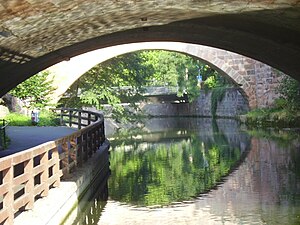
Steuben Bridge
Coordinates: 49 ° 27 '8 " N , 11 ° 5' 9" E
| Steuben Bridge Nuremberg | ||
|---|---|---|
| Convicted | Road traffic | |
| Subjugated | Pegnitz | |
| place | Nuremberg | |
| construction | Arch bridge | |
| location | ||
|
|
||
The Steubenbrücke is a bridge structure in Nuremberg . It bridges both arms of the Pegnitz before they enter the old town, and thus also the island of Schütt in its eastern area, and is located in front of the east side of the outer city wall from the second half of the 15th century.
history
Steuben Bridge
The first Steubenbrücke was built in 1847 under the Nuremberg city planner Bernhard Solger . 19th century plans to name the two bridges after Theodor von Cramer-Klett and Mayor Christoph von Seiler were finally rejected in 1894. Officially, the term 'casemate bridges' was preferred. The bridging of the Pegnitz valley between Laufertor ditch and Marientor ditch was considerably widened in 1930 and, at the suggestion of the American Steuben Society, was renamed after the German-American general Friedrich Wilhelm von Steuben (1730–94).
Franz Josef Strauss Bridge
The traffic engineering development after the Second World War required another crossing of the Pegnitz Valley east of the Steubenbrücke: the New Steubenbrücke, inaugurated in 1962, for the traffic flow in a south-north direction. In 1989 it was renamed Franz-Josef-Strauss-Brücke in honor of the Bavarian Prime Minister (since 1978) Franz Josef Strauss (1915–1988) who died in office .
literature
- Nuremberg City Archives, City Lexicon
- City Archives Nuremberg, StadtAN C 7 / I; F 2.
- Imhoff, Nuremberg, page 280
- Fleischmann, bridges.

