Steufzger pond
| Steufzger pond | ||
|---|---|---|

|
||
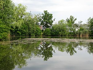
| Steufzger Weiher from the south | ||
| Geographical location | Kempten (Allgäu) , Bavaria | |
| Drain | Rottach → Iller | |
| Data | ||
| Coordinates | 47 ° 42 '59.1 " N , 10 ° 17' 53.3" E | |
|
|
||
| Altitude above sea level | 716 m | |
| surface | 0.462 ha | |
| length | 100 m | |
| width | 70 m | |
| scope | 270 m | |
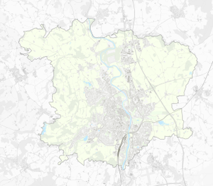
The Steufzger Weiher is a pond in Kempten (Allgäu) . The pond is located directly west of the Heussring and south of the industrial park on Lindauer Straße. It has an area of 0.46 ha . There is a football field right by the lake and on Margaretha- and Josefinenweg, which leads past to the south .
The pond, which was only created with the development of the Steufzgen district with a dense development at the end of the 1960s and the beginning of the 1970s, is located a good 900 meters east-northeast of the city pond . The landowner is the city of Kempten, which leases the pond.
Individual evidence
- ^ City of Kempten (ed.): Kempten im Allgäu. (3rd documentation), Kösel, Kempten 1972, p. 68.
- ↑ Searching for traces - Waller in Steufzger Weiher allegedly eats young birds | all-in.de ( page no longer available , search in web archives ) Info: The link was automatically marked as defective. Please check the link according to the instructions and then remove this notice. , May 28, 2011
