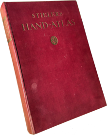
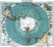
Stieler's hand atlas
Stieler's hand atlas or fully entitled as hand atlas covering all parts of the world and the world structure , was a widely used German atlas initiated by Adolf Stieler (1775–1836) . Published by Justus Perthes in Gotha, it was published in ten revisions from 1816 to 1944. Like many publications at the time, each edition was published in partial deliveries and supplements were added after completion. The first edition appeared in four deliveries and was supplemented by eight supplements, the eighth edition in 32 monthly parts.
expenditure

The first edition by Stieler and Christian Gottlieb Reichard (1758–1837) appeared in 1817. The 50 cards were completed by 1823 in four partial deliveries. It was expanded to 77 cards in eight supplement deliveries by 1835. The last supplement was headed by Heinrich Berghaus (1797–1884).
After Stieler's death, Johann Friedrich von Stülpnagel (1786–1865) continued work with the second (1845–1847) and third edition (1852–1854). They contained 83 cards. The fourth edition was published 1862–1864, the fifth 1866–1868, each with 84 cards. Carl Vogel's (1828–1897) sheet of South-West Germany and Switzerland in this edition can be regarded as the first modern atlas map. The factual writing by H. Eberhardt and the three-dimensional representation of the terrain by W. Weiler were widely imitated.
It was only with the sixth edition (1871–1875, 90 maps) by August Petermann (1822–1878), Hermann Berghaus (1828–1890) and Carl Vogel, however, that the work achieved the scientific quality and the unsurpassed relief representations that Stieler's Hand Atlas so made famous. Together with Bernhardt Perthes (1821–1857), Petermann brought great experience from the elaborate production of the map supplements to the Petermanns Geographische Mitteilungen, which had been published since 1855 .
A seventh edition was published in 1879–1882; an eighth 1888–1891 (95 cards each), both under the direction of Hermann Berghaus, Carl Vogel and Hermann habenicht (1844–1917). Although the printing process had meanwhile largely switched to lithography , a number of maps in Stieler's Hand Atlas continued to be produced as copperplate engravings on manual printing presses until the 1890s .
With 100 cards, the ninth edition (1901–1905) of habenicht achieved double the number of the first edition and was the first to be printed on cylinders, making it accessible to a wider audience thanks to the lower price. It is also considered to be the best edition, in which all maps achieved the quality Vogel's map of 1868. 16 maps from this were translated into English and converted to the Anglo-American measurement system. Part of the 11th edition of the Encyclopædia Britannica (1910–1911).
Hermann Haack (1872–1966) edited the tenth “Hundred Years Edition” (1920–1925). In addition to the 108 maps, it contained a list of names with 320,000 entries and is considered the most extensive atlas of modern times. Their representations of the terrain make the writing difficult to read.
English versions of the ninth and tenth editions appeared as Stieler's Atlas of Modern Geography and with similar titles in French, Italian and Spanish. An international edition (1934–1940) remained unfinished. Due to the Second World War , only 84 of the planned 114 cards appeared. The work was engraved in 432 copper plates and was preserved.
| year | output | Main maps | Names | Comments |
|---|---|---|---|---|
| 1816-1833 | Default | 50 | Adolf Stieler and Christian Gottlieb Reichard | With eight supplements delivered by July 1835, the number of sheets rose to 77 |
| 1834-1845 | first | 50 | Adolf Stieler and Christian Gottlieb Reichard | With eight supplements delivered by July 1835, the number of sheets rose to 77 |
| 1845-1847 | second | 83 | Friedrich von Stülpnagel | - |
| 1852-1854 | third | 83 | Friedrich von Stülpnagel | - |
| 1862-1864 | fourth | 84 | - | - |
| 1866-1868 | fifth | 84 | (August Petermann) | - |
| 1871-1875 | sixth | 90 | August Petermann, Hermann Berghaus and Carl Vogel | - |
| 1879-1882 | seventh | 95 | Hermann Berghaus, Carl Vogel and Hermann habenicht | - |
| 1888-1891 | eighth | 95 | Hermann Berghaus, Carl Vogel and Hermann habenicht | - |
| 1901-1905 | ninth | 100 | Hermann habenicht, Herrmann Haack | Switch to lithography, copper plates preserved, basis for 16 English maps of the 11th edition of the Encyclopædia Britannica |
| 1920-1925 | tenth ("centenary edition") | 108 | Hermann Haack | Copper plates preserved, directory of names with 320,000 entries |
| 1934-1940 | international (eleventh) | 84 | - | Copper plates preserved, unfinished |
publishing company
The reference “Gotha: Justus Perthes” adorns every sheet of the manual atlas. He refers to the " Justus Perthes 'Geographische (Verlags-) Anstalt Gotha ", which was located in Gotha from 1785–2016 under different ownership structures and, in addition to this work, was also known for other atlases such as "Berghaus' Physical Atlas".
Only shortly before his death did the founder of the publishing house Justus Perthes begin planning this atlas with Adolf Stieler and Christian Gottlieb Reichard. The aim was a "... Comfortable format, the greatest possible accuracy, clarity and completeness, but appropriate selection, uniformity of projection and scale, beautiful paper, good printing, careful illumination, cheap price ...". The edition did not begin until the publisher's year of death and the publisher only achieved world fame for this work much later.
price
Justus Perthes initially set the price for the subscription at eight Saxon thalers , half of which was due for the first and third of the four partial deliveries. If you bought five copies, you got a sixth for free. With the first partial delivery in April 1817, he had to increase the price to 10 thalers. Copies on wove paper were worth 12 thalers. When the last delivery appeared in March 1823, the price was 12 thaler 12 groschen for the bound copy. With the first delivery of supplements in November, it rose to 13 thaler 12 groschen. In September 1828, the number of sheets to 70 and the price rose to 17 1 / 4 Taler.
literature
- Jürgen Espenhorst: Andree, Stieler, Meyer & Co, Handatlanten of the German-speaking area (1800–1945) together with forerunners and descendants at home and abroad, Bibliographisches Handbuch. Schwerte 1994, ISBN 3-930401-33-9 , pp. 44-137.
- Jürgen Espenhorst: Petermann's Planet, A Guide to German Handatlases And Their Siblings Throughout the World 1800–1950. Volume I: The Great Handatlases. Schwerte 2003, ISBN 3-930401-35-5 .
- Jürgen Espenhorst: Petermann's Planet, A Guide to German Handatlases And Their Siblings Throughout the World 1800–1950. Volume II: The Rare and Small Handatlases. Schwerte 2008, ISBN 978-3-930401-36-9 .
- Franz Köhler: Gothaer ways in geography and cartography. Gotha 1987, ISBN 3-7301-0871-9 .
- Gottfried Suchy: Gotha geographer and cartographer. Gotha 1985.
Web links
- Justus Perthes , life
- Atlas , Justus Perthes
- August Petermann , Cartographic Achievements
Individual evidence
- ↑ a b perthes.de - Publishing history Justus Perthes: Zeittafel. In: perthes.de. Retrieved July 30, 2016 .
- ^ A b c Heinrich Berghaus: Preliminary remarks on the eighth supplement delivery or third delivery of new versions of Stieler's Hand Atlas, July 1835, Gotha. Digitized version ( Memento of the original from July 30, 2016 in the Internet Archive ) Info: The archive link was inserted automatically and has not yet been checked. Please check the original and archive link according to the instructions and then remove this notice. (PDF; 7.4 MB).
- ↑ Wolfgang Lierz: Maps from Stieler's Hand-Atlas in the "Encyclopaedia Britannica". In: Cartographica Helvetica. Issue 29, 2004, ISSN 1015-8480 , pp. 27-34 full text .
- ↑ copper plates. In: uni-erfurt.de. Retrieved July 30, 2016 .
- ↑ Pre-specification : Adolf Stieler, Christian Gottlieb Reichard: Hand-Atlas over all parts of the earth according to the newest condition and over the world structure. In: atlass.info. Retrieved August 3, 2016 (1816–1833).
- ↑ 1st edition (75–83 maps): Adolf Stieler & Friedrich von Stülpnagel: Stieler's hand atlas about all parts of the earth and about the world structure. In: atlass.info. Retrieved August 3, 2016 (1834-1845).
- ↑ 2nd edition: Friedrich von Stülpnagel: Stieler's hand atlas about all parts of the earth and about the world structure. In: atlass.info. Retrieved August 3, 2016 (1846-1852).
- ↑ 3rd edition: Friedrich von Stülpnagel: Stieler's hand atlas about all parts of the earth and about the world structure. In: atlass.info. Retrieved August 3, 2016 (1853–1862).
- ↑ 4th edition: August Petermann: Stieler's hand atlas about all parts of the earth and about the world structure. In: atlass.info. Retrieved August 3, 2016 (1863–1867).
- ↑ 5th edition: August Petermann: Hand-Atlas over all parts of the earth and over the world structure. In: atlass.info. Retrieved August 3, 2016 (1868–1874).
- ↑ 8 - August Petermann renovates the Palestine map of the Stieler Hand Atlas, before 1868. In: Perthes Gotha Collection. Retrieved July 30, 2016 .
- ↑ 6th edition: Hermann Berghaus, Carl Vogel: Hand atlas over all parts of the earth and over the world structure. In: David Rumsey Historical Map Collection. 1875, Retrieved July 28, 2016 .
- ↑ 7th edition: Adolf Stieler's Hand Atlas about all parts of the earth and about the world building , 1882–1889, 95 maps (Hermann Berghaus & Carl Vogel)
- ↑ 8th edition: Alexander Supan: Adolf Stieler's Hand Atlas over all parts of the earth and over the world structure. In: maproom.org. 1891, Retrieved July 28, 2016 .
- ↑ 9th edition: Hermann Haack: Stieler's hand atlas. In: Biodiversity Heritage Library. 1907, accessed July 31, 2016 . (100 cards in copper engraving with 162 additional cards)
- ↑ a b 11 - On the 50th anniversary of Hermann Haack's death. In: Perthes Gotha Collection. Retrieved July 30, 2016 .
- ↑ 10th edition: Stieler's Hand Atlas , 1925–1945, 108 maps (Hermann Haack)
- ↑ International edition: Hermann Haack: Stieler grand atlas de geographie modern. In: atlass.info. Retrieved August 3, 2016 (1934-1940).
- ^ Justus Perthes, publisher's postscript to the plan and announcement of the Hand-Atlas, August 1816, Gotha. Digitized version ( memento of the original from July 30, 2016 in the Internet Archive ) Info: The archive link was inserted automatically and has not yet been checked. Please check the original and archive link according to the instructions and then remove this notice. (PDF; 7.4 MB).


