
August Petermann

August Heinrich Petermann (born April 18, 1822 in Bleicherode ; † September 25, 1878 in Gotha (suicide)) was one of the most important geographers and cartographers of the 19th century.
Life

Born in the center of Bleicherode as the son of an actuary, he came to the grammar school in Nordhausen at the age of 14 and dealt with geography and drawing maps from an early age . In 1839 he entered Heinrich Berghaus's art school in Potsdam in order to receive a scientific and technical training in cartography . In 1845 he moved to Edinburgh and in 1847 to London. In 1854 he moved from London to Gotha in Thuringia , which has had an excellent scientific reputation since the work of the astronomer and geodesist Franz Xaver von Zach . A year later he founded Petermanns Geographische Mitteilungen , an important German-language specialist journal for geography .
First German Geographers' Day
On July 23 and 24, 1865, the first “Assembly of German Masters and Friends of Geography” met in Frankfurt am Main , this was the first German geography conference . The assembly met on the initiative of Otto Volger and August Petermann. Due to his services, Petermann had been master of the Free German Hochstift since 1860 . Government agencies were written to, newspapers were invited, and all geographic societies were notified. 72 geographers came from the German-speaking countries of Central Europe, including such influential men as Georg von Neumayer , Ferdinand von Hochstetter , President of the Imperial and Royal Geographic Society, Wilhelm Ihno v. Freeden , the director of the Grand Ducal Oldenburg Navigation School and Friedrich Harkort . Since the Frankfurt Goethe-Haus turned out to be too small for the large gathering, the meeting was held in the new hall building on Junghofstrasse. Eduard Rüppell and J. Wallach from the Frankfurt Geographical Association were present. The theme of the conference was "The event of a German North Trip".
Theory of the ice-free Arctic Ocean
August Petermann gave a lecture at this meeting on "The exploration of the Arctic Central region through a German trip to the north". He complained about the lack of support from “our first seafaring powers, the Prussian and Austrian governments” and asked for donations for a “reconnaissance trip” in the sea between Spitsbergen and Novaya Zemlya . In his opinion, thanks to the Gulf Stream , the sea would not completely freeze over there, not even in winter, so that once the drift ice had penetrated, a free navigable sea would be found up to the North Pole . Petermann's plans were received with great attention in Germany and Austria.
German north polar research began with Petermann's remarks in Frankfurt. The first German North Pole expedition of 1868 and the second of 1869/70, both of which were carried out by Captain Carl Koldewey with instructions from Petermann, remained without the result of the North Pole discovery . After all, his vision led to the discovery of Franz Joseph Land by Julius von Payer and Carl Weyprecht . The original ship of the First German North Polar Expedition, the Nordic Jagt Greenland , built in 1867, has been preserved to this day and is used as an active museum ship of the German Maritime Museum .
Petermann's Geographical Communications (PGM)
His name is closely linked to the geographic publisher Justus Perthes , which celebrated Petermann's 150th anniversary in Gotha in 2004. The journal Petermanns Geographische Mitteilungen (first published in 1855), also known as PGM for short, became the most important German-language specialist journal in geography, in which all of the important geographical discoveries of the 19th and 20th centuries were published. In theoretical terms, too, it was one of the leading bodies in the geosciences . These publications and the maps of the authors enriched the map collection and library in Gotha's Justus-Perthes-Straße. The publication of the PGM was stopped at the end of 2004.
Cartographic services
August Petermann is considered an excellent, internationally highly respected cartographer. After his training in Potsdam he worked in Edinburgh with Alexander Keith Johnston with British scholars, seafarers and explorers on the English edition of Berghaus' Physical Atlas. His maps of population density and the spread of cholera in England stand out from the London period, illustrating not only social aspects of infectious diseases in the early stages of their medical research. With them, Petermann joined the founding generation of thematic maps .
With the maps for Petermanns Mitteilungen , such more topographical characters come to the fore. The publisher of the magazine benefited from innovations in card technology in Gotha: Bernhardt Perthes (1821–1857, grandson of the company founder) had developed an electro-chemical process for duplicating copperplate plates with electroplating , which drastically reduced the amount of work and time required allowed the production of map excerpts. Emil von Sydow had brought color lithography to readiness for production in card production, which also increased productivity and made it possible to use color on a wide scale for conveying information in cards. After more than a decade of practice, both card technologies had their teething troubles and the combination of both techniques in card production behind them. With great organizational talent, Petermann turned this lead into a best seller. Since Petermann not only reconstructed the travel routes, but also integrated them into maps, many authors saw this as a great advantage and turned to the communications for the purpose of implementation, which was usually done quickly and in an appealing quality. No booklet was published without a map insert, and 25 to 35 map inserts appeared per year. The development effort for this was comparable to that for a school atlas. The synthetic approach in the presentation of the new discoveries sometimes brought about hypotheses, which led to annoyance or even controversy between the authors and the very self-confident editor.
These maps were not only used for communications, they were also important sources for the three revised editions of Stieler's Hand Atlas , in which Petermann played a key role. The redesign of the hand atlases is thanks to his influence. The scales were converted to the international metric system. In addition to the politico-geographic statements, physical-geographic statements such as the representation of deserts, periodically water-bearing rivers, numbers for sea depths, elevation numbers, names of peaks, etc. have been added to larger-scale maps for areas with a high population density. With the growth of cities in the 19th century, the representation of places became denser, and an objectified, leaner, but nevertheless legible font was developed for the increased names. In Hermann Berghaus and Carl Vogel (1828–1897), Petermann was assisted by outstanding cartographers, and Vogel in particular developed a significantly improved relief representation in hatches. The high content density and display quality repeatedly resulted in complaints about black copies .
The development of the atlas maps in the division of labor between up to seven map processors, engravers, lithographers, printers and other workers required the development of a specific business organization. The changeover from the publishing system to the factory system, begun by publisher Bernhardt Perthes, also required Petermann's organizational talent after his early death. But experts at Gothaer Anstalt disagree with the view that Petermann had a managerial function. It cannot be overlooked that Petermann developed little sense for theoretical questions of cartography and he faced the upswing in the natural sciences of his time as an autodidact.
Since there was no higher education for cartographers until well into the 20th century, Petermann took over the training following the example of his teacher Heinrich Berghaus . With high craftsmanship, this includes Hermann habenicht (1844–1917) and Bruno Hassenstein (1839–1902) among others Ernst Debes (1840–1923), Georg Hirt (1841–1916) and Ludwig Friederichsen , who had their own successful cartographic work Operated in Leipzig, Munich and Hamburg demonstrated the high school of Petermann.
Familiar
August Petermann married Clara Mildred Leslie on September 3, 1856 in Richmond, Surrey . The couple had two daughters. The marriage ended in divorce in 1875.
Honors
In 1860 Petermann was elected to the German Academy of Sciences Leopoldina . In 1868 the Royal Geographical Society in London awarded Petermann its highest honor, the Great Gold Medal. The German Antarctic Expedition 1938/39 named three mountain ranges in the Wohlthat massif ( Antarctica ) Petermann chains . In addition, the Petermannspitze (2970 m) in East Greenland , Cape Petermann on the island of Nowaja Semlja , Cape Petermann , Petermannfjellet and Petermannbreen on Spitzbergen , the Petermann Ranges in Australia , the Petermann Island in the Antarctic and the Petermann Glacier in northwest Greenland. Petermann Land , which Julius Payer had identified north of Franz Josef Land, turned out to be a phantom island .
The lunar crater Petermann was named after him. The plant genus Petermannia F.Muell. from the Petermanniaceae family is named after him.
In 1998 the city of Gotha named a park path after the cartographer. This leads past the Petermann monument donated by the German Geographical Societies after Petermann's death and executed by Max Hoene , a memorial stone that is adorned by a bronze plaque with a relief portrait of the recipient.
“So he stood there, an ornament to his science and his country. Then a storm came and tore it down, as Homer said: People are like leaves on trees, when the autumn wind comes it blows them down and sprinkles the ground with it. "
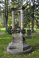
Petermann's tomb, Gotha main cemetery

Memorial plaque in Bleicherode

Monument in Bleicherode


literature
- Erik Arnberger : Handbook of Thematic Cartography . Vienna: 1966.
- Ursula von den Driesch: Petermann, August. In: New German Biography (NDB). Volume 20, Duncker & Humblot, Berlin 2001, ISBN 3-428-00201-6 , p. 237 f. ( Digitized version ).
- Max Eckert : The map science. Research and basics of cartography as a science . 2 volumes, Berlin and Leipzig 1921 and 1925.
- Ingo Heidbrink (Ed.): 81 ° 45 'North under sails. The Nordic Chase Greenland - from the first German polar research ship to an active museum ship. German Maritime Museum, Bremerhaven 2005.
- Matthias Hoffmann, Rainer Huschmann: August Heinrich Petermann. A new era begins . In: Gothaer Geographen und Kartographen , Gotha 1985, pp. 77–84.
- Franz Köhler: Gothaer ways in geography and cartography . Gotha 1987.
- J. Smits: Petermann's Maps. Carto-bibliography of the maps in Petermanns Geographische Mitteilungen, 1855–1945. Hes & De Graaf, 't Goy-Houten 2004, ISBN 90-6194-249-7 .
- Lars Schmitz-Eggen: Lost in the pack ice . Books on Demand, Norderstedt 2007, ISBN 978-3-8334-6877-3 .
- Philipp Felsch : How August Petermann invented the North Pole . Luchterhand, Munich 2010, ISBN 3-630-62178-3 .
- Hugo Wichmann: Petermann, August . In: Allgemeine Deutsche Biographie (ADB). Volume 26, Duncker & Humblot, Leipzig 1888, pp. 795-805.
Web links
- Literature by and about August Petermann in the catalog of the German National Library
- Justus Perthes publishing house and timetable
- The 2nd German north polar voyage in 1869/70
- Federal Agency for Cartography and Geodesy, Directory of German-speaking geographical names of the Antarctic
- Ulrich Hübsch: August Petermann 1822–1878 (PDF; 427 kB). In: Polarforschung 48, 1978, pp. 183-187
- August Petermann (encyclopedia entry). In: Meyers Großes Konversations-Lexikon. 6th edition, Bibliographisches Institut, Leipzig / Vienna 1905-1909. 1909, Retrieved June 12, 2018 .
Individual evidence
- ↑ August Heinrick Petermann at familysearch.org, accessed on September 7, 2015.
- ↑ Lotte Burkhardt: Directory of eponymous plant names - Extended Edition. Part I and II. Botanic Garden and Botanical Museum Berlin , Freie Universität Berlin , Berlin 2018, ISBN 978-3-946292-26-5 doi: 10.3372 / epolist2018 .
- ^ Ernst Behm: Nekrolog auf August Petermann. In: Petermanns Geographische Mitteilungen. 1878, Retrieved June 12, 2018 .
| personal data | |
|---|---|
| SURNAME | Petermann, August |
| ALTERNATIVE NAMES | Petermann, August Heinrich (full name) |
| BRIEF DESCRIPTION | German geographer and cartographer |
| DATE OF BIRTH | April 18, 1822 |
| PLACE OF BIRTH | Bleicherode near Nordhausen |
| DATE OF DEATH | September 25, 1878 |
| Place of death | Gotha |