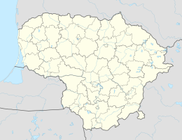
Stoniškiai
| Stoniškiai | ||
|
||
| State : |
|
|
| District : | Tauragė | |
| Municipality : | Pagėgiai | |
| Office : | Stoniškiai | |
| Founded : | before 1785 | |
| Coordinates : | 55 ° 12 ′ N , 21 ° 45 ′ E | |
| Inhabitants (place) : | 178 (2011) | |
| Time zone : | EET (UTC + 2) | |
| Postal code : | 99304 | |
| Status: | Village | |
|
|
||
Stoniškiai ( German Stonischken ) is a village in the Tauragė district of Lithuania . The place is the center of the administrative district (Seniūnija) Stoniškiai and belongs to the municipality Pagėgiai .
Geographical location
Stoniškiai is located in the southwest of Lithuania , in the former Memelland , about eleven kilometers northwest of the municipality of Pagėgiai . National road 141 , which connects Kaunas with Klaipėda , and the railway line Sowetsk – Klaipėda , on which Stoniškiai has a train station, run through the village . However, passenger train traffic has been discontinued since 2011. The larger neighboring village of Rukai is two kilometers southeast .
Place name
The name points to a higher-ranking local founder. A person named Stonis (Stanislaus) cannot be excluded. Etymologically obvious are Prussian-Lithuanian "stoniškas" = estate, "stone" = the cattle in the barn, "stonia" = stable horse, carriage horse.
history
The place was founded before 1785 and was initially a box . Later a non-inherited district was added. In 1893 the two rural communities of Schatull Stonischken and Erbfrei Stonischken merged to form the rural community of Stonischken, which was located in the administrative district of Rucken in the (rural) district of Tilsit . In 1920 it was incorporated into the Pogegen district (lit. Pagėgių apskritis). From 1939 to 1944, the neighboring towns of Alex-Meschkeit , Kowgirren and Maszeiten were incorporated into Stonischken, which was now in the Heydekrug district.
After being incorporated into the Lithuanian Soviet Socialist Republic in 1944, Stoniškiai was initially incorporated into the municipality (lit. valsčius) Rukai in the Pagėgiai district (lit. Pagėgių apskritis). In 1947 the seat of the Volost was moved to Stoniškiai. In 1950 the Wolost and the district were dissolved and replaced by the district (lit. apylinkė), whose seat was (again) in Rukai, or Rajon. In 1954 the seat of the district moved (again) to Stoniškiai. Since 1962 the area was in the Šilutė district . At the end of the 1980s, the seat of the district was moved back to Rukai. In 1995, the district (lit. Seniūnija) Stoniškiai was founded, which has been in the Pagėgiai municipality since 1999 . As the seat of an administrative district, Stoniškiai was given a coat of arms in 2006.
Population development
| year | Residents | Remarks |
|---|---|---|
| 1818 | 10 | |
| 1871 | 88 | Box Stonischken and Erbfrei Stonischken |
| 1910 | 144 | |
| 1925 | 168 | |
| 1939 | 469 | (Apparently) including the incorporated surrounding places |
| 1970 | 301 | |
| 1987 | 268 | |
| 2001 | 228 | |
| 2011 | 178 |
economy
At Stoniškiai, plans from the Cretaceous period were dismantled until 1994 .
school
There is a secondary school in Stoniškiai.
Stoniškiai District
The Stoniškių seniūnija has existed since 1995, which belonged to the Rajongemeinde Šilutė until 1999 and has since been assigned to the municipality of Pagėgiai . In the district there are 25 villages with a total of 2,019 inhabitants on an area of 134 km² (as of 2011). The administrative district has been divided into the two subdistricts (lit. Seniūnaitija) Stoniškių seniūnaitija and Šilgalių seniūnaitija since 2009. The district includes:
| Place name | German name | Subdistrict | Place name | German name | Subdistrict | |
|---|---|---|---|---|---|---|
| Aleknai | Alex-Meschkeit | Stoniškiai | Peleniai | Pellehnen | Šilgaliai | |
| Anužiai | Annuschen | Šilgaliai | Plaškiai | Plaschken | Stoniškiai | |
| Berštininkai | Bersteningken | Stoniškiai | Pleinė | Stoniškiai | ||
| Dinkiai | Dingken | Stoniškiai | Rėžiai | Steppon-Rödszen | Stoniškiai | |
| Karceviškiai | Klein Karzewischken | Stoniškiai | Rukai | Move | Stoniškiai | |
| Kovgiriai | Kowgirren | Stoniškiai | Spengiai | Spingen | Stoniškiai | |
| Kuciai | Cut | Šilgaliai | Stoniškiai | Stonischken | Stoniškiai | |
| Lazdėnai | Laser stretching | Stoniškiai | Stumbragiriai | Stumbragirren | Stoniškiai | |
| Mažaičiai | Mas times | Stoniškiai | Šilgaliai | Schillgallen | Šilgaliai | |
| Naujapieviai | Pleine | Stoniškiai | Šuneliai | Schunellen | Stoniškiai | |
| Nausėdai | Nausseden | Šilgaliai | Tutliai | Tuttling | Stoniškiai | |
| Pageldyniai | Pageldienst | Stoniškiai | Vičiai | Wittschen | Šilgaliai | |
| Pakamoniai | Pakamones | Stoniškiai |
Web links
Individual evidence
- ↑ Local directory of the Gumbinnen district 1818
- ^ A b Dietrich Lange: Geographical register of East Prussia including the Memel area, the Soldau area and the Reg.-Bez. West Prussia (1919-1939)
- ↑ a b c d census data
- ^ Statistical office of the Memel area (edit.): Directory of the localities of the Memel area [1926], Kurt Siebert & Cie - Memel - 1926
- ^ Tarybų Lietuvos enciklopedija, T. 4 (Simno-Žvorūnė). - Vilnius: Vyriausioji enciklopedijų redakcija, 1988.


