Swartz Bay Ferry Terminal
| Swartz Bay Ferry Terminal | |||
|---|---|---|---|
| Data | |||
| Port type | Sea port / ferry port | ||
| Piers / quays | 5 | ||
| Geographic information | |||
| place | Swartz Bay | ||
| province | British Columbia | ||
| Country | Canada | ||
| Swartz Bay Ferry Terminal | |||
| Coordinates | 48 ° 41 ′ 19 ″ N , 123 ° 24 ′ 39 ″ W | ||
|
|||
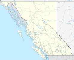
The Swartz Bay Ferry Terminal is a ferry terminal in the Canadian province of British Columbia . It is located in the south of Vancouver Island on the bay of Puget Sound , near Sydney in the Capital Regional District and the tidal range here is usually between 0.5 and 3 meters. The ferry port is located on the route of Highway 17, among other places .
BC Ferries ( British Columbia Ferry Services Inc. ), as the main operator of the ferry connections on the west coast of British Columbia, operates various routes from here.
There is a public transport connection from the ferry terminal to downtown Victoria . The route is currently served by bus routes 70 (express bus), 71, 72 and 81 of the Victoria Regional Transit System . With the Expressbus 70 the journey time from the ferry terminal to the city center is less than an hour.
Routes
From here the following goals are approached:
- to Vancouver via ( Tsawwassen )
- to Galiano Island (Sturdies Bay)
- to Mayne Island (Village Bay)
- to Pender Island (Otter Bay)
- to Saturna Island (Lyall Harbor)
Web links
Individual evidence
- ^ Sidney (# 7260) Tidal Prediction. Fisheries and Oceans Canada , accessed April 29, 2016 .

