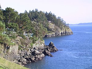
Pender Island
| Pender Island | ||
|---|---|---|
| Pender Island (north) | ||
| Waters | Strait of Georgia , (Pacific Ocean) | |
| Archipelago | Gulf Islands | |
| Geographical location | 48 ° 47 ′ N , 123 ° 17 ′ W | |
|
|
||
| length | 14 km | |
| width | 4.6 km | |
| surface | 34 km² | |
| Highest elevation | Mount Norman 244 m |
|
| Residents | 2236 (2011) 66 inhabitants / km² |
|
| Gulf Islands | ||
Pender Island is an island in the Canadian province of British Columbia . It belongs to the southern Gulf Islands in the Strait of Georgia and is located between Mayne Island in the northeast, Saturna Island in the east, Prevost Island in the northwest and Duncan on Vancouver Island in the west.
Pender Island is actually made up of two islands, North Pender and South Pender, separated by a canal built in 1903. It was not until 1955 that the two islands were again connected by a single-lane bridge. 2266 people (North Pender: 2035; South Pender: 201) live on the approximately 34 km² double island, with most of them living around Magic Lake on North Pender. Administratively, the islands belong to the Capital Regional District and there, u. a. together with Galiano Island , Mayne Island , Saturna Island , to the Capitel G district .
history
The island was inhabited by coastal Salish before the arrival of the first Europeans . Today there is a reservation called Pender Island 8 with an area of 3.2 hectares at Hay Point on South Pender Island, inhabited by members of the Tsawout and Tseycum First Nations.
Francisco de Eliza reached Pender in 1791 and named the island "Ysla de San Eusevio". The island got its current name from the British captain George Henry Richards during his research trip 1858-1859 with the HMS Plumper , who named it after Daniel Pender, one of his officers. The first settlers came to the island in 1886.
The Poets Cove Resort was built on a former village called St'eyus in Bedwell Harbor , not far from Hay Point, where the Tseycum and Tsawout salmon were dried. At the end of the 19th century, the colonial power had renamed the village after a ship in Egeria Bay . The archaeological site there, which may go back 5000 years, has been under protection since 1955. In 2002, construction began on the resort in the unceremoniously renamed bay that the government had allowed. It wasn't until the Tseycum complained that the Calgary contractor applied for a permit. During the construction work, the remains of at least 50 dead were excavated. On February 10, 2003, those concerned filed a lawsuit for violating the Heritage and Conservation Act . Olga Ilich, former President of Suncor Development Ltd. , became Minister of Tourism and at the same time responsible for the protection of archaeological sites in the province. The specialist for archaeological companies IR Wilson Consultants Ltd. took three years to even remotely compensate for the damage done to research.
In 2007, the provincial government signed a treaty with the Tsawwassen First Nation that also gave them fishing rights around Pender Island. Against this, the Sencot'en Alliance , which was founded specifically for this purpose, turned in 2006 , which refers to its legal claims from the Douglas Treaties of 1852, and to which the Tsartlip , Tsawout and Pauquachin from the Saanich Peninsula and the Semiahmoo from White Rock belong.
traffic
Pender Island is served by BC Ferries from Swartz Bay Ferry Terminal (near Victoria), Tsawwassen (near Vancouver) and the neighboring Gulf Islands. There are also regular connections by seaplanes, a small airfield and a water taxi service. Bedwell Harbor is a customs area for visitors from the USA, as the island is right on the border.
Web links
- North Pender Island . In: BC Geographical Names (English)
- South Pender Island . In: BC Geographical Names (English)
supporting documents
- ^ North Pender Island Trust Area Profile. Census 2011. In: Statistics Canada . March 1, 2013, accessed July 20, 2013 .
- ^ South Pender Island Trust Area Profile. Census 2011. In: Statistics Canada . March 1, 2013, accessed July 20, 2013 .
- ^ Andrew Scott: The Encyclopedia of Raincoast Place Names: A Complete Reference to Coastal British Columbia . Harbor Publishing, Madeira Park, BC 2009, ISBN 978-1-55017-484-7 , pp. 456 (English).
- ^ A Gulf Islands Patchwork , BC Historical Association, 1961, pp. 33-35.
- ^ This haunted place, straight.com, August 25, 2005
- ↑ 38th Parliament Members at dissolution on April 14, 2009
- ^ Tsawwassen Treaty 'Fraud' Say Gulf Island First Nations, in: The Tyee, September 14, 2007
- ↑ Alliance maps out at-risk treaty lands, canada.com, June 22, 2006 ( Memento of the original from March 27, 2009 in the Internet Archive ) Info: The archive link was inserted automatically and has not yet been checked. Please check the original and archive link according to the instructions and then remove this notice.


