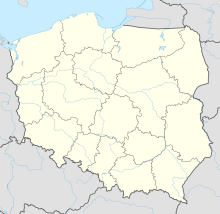
Synagogue (Złotów)
Coordinates: 53 ° 21 '46.8 " N , 17 ° 2' 6.4" E
The synagogue in Złotów (German Flatow ), a Polish city in the Greater Poland Voivodeship , was built in 1878/79. The historicist- style synagogue on Friedrichsplatz was destroyed in the November pogrom in 1938 .
See also
literature
- Klaus-Dieter Alicke: Lexicon of the Jewish communities in the German-speaking area. Volume 1: Aach - Groß-Bieberau. Gütersloher Verlagshaus, Gütersloh 2008, ISBN 978-3-579-08077-2 ( online edition ).
Web links
- Virtual Shtetl (English)


