For days La
| For days La | |||
|---|---|---|---|
|
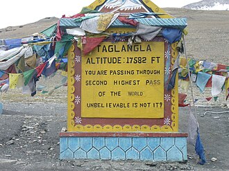
Street sign on Taglang La with incorrect elevation |
|||
| Compass direction | northwest | Southeast | |
| Pass height | 5317 m | ||
| Leh district in Ladakh ( India ) | |||
| Watershed | Gya → Indus | → Tsarap | |
| Valley locations | Leh | Keylong | |
| expansion | Pass road | ||
| Mountains | Himalayas | ||
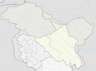
| map | |||
|
|
|||
| Coordinates | 33 ° 30 ′ 29 " N , 77 ° 46 ′ 15" E | ||
The Taglang La (also Tanglang La ) is located in the Union Territory of Ladakh ( Leh District ) in northwest India and is a 5317 meter high, seasonally (June-September) passable mountain pass . The importance of Taglang La is that it is located on the major transport link of the Manali-Leh Highway .
According to information boards of the Indian road authorities, Taglang La is the second highest passable pass in the world at 5359 meters. Only the Kardung Pass is higher with an alleged 5604 meters. However, it must be assumed that the height of the Taglang La pass of 5359 meters does not correspond to the truth, because of record claims. In the case of the Kardung La, this was confirmed by GPS : Catalan scientists measured only 5360 meters instead of 5604 meters.

