Carding La
| Khardung La | |||
|---|---|---|---|
|
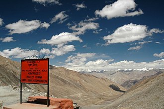
Kardong La - View of the Karakoram |
|||
| Pass height | 5360 m | ||
| Union Territory | Ladakh | ||
| Watershed | Indus | Shyok → Indus | |
| Valley locations | Leh | Diskit ( Nubra Valley ) | |
| expansion | Pass road | ||
| Mountains | Ladakh Range | ||
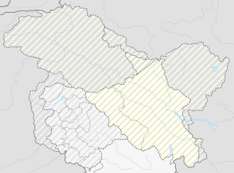
| Map (Ladakh) | |||
|
|
|||
| Coordinates | 34 ° 16 '44 " N , 77 ° 36' 16" E | ||
The Kardung Pass (also Khardong Pass, Khardung La ) is located in the Ladakh Range in the Ladakh district in northwest India and is one of the highest motorable mountain passes on earth.
From Leh ( 3500 m above sea level) the mostly paved road winds 39 kilometers to the Kardung Pass, which connects the Indus Valley with the Nubra Valley through which the Shyok flows . Because of the border conflict between India and Pakistan and China (the Siachen Glacier in the Karakoram is a strategically important point ), the road is cleared and kept open almost all year round, especially for military vehicles. Halfway there you pass a checkpoint of the Indian Army (South Pullu), where the traveler is asked for the entry papers. (The permit or the travel authorization for seven days can be obtained for about 100 rupees from various travel agencies in Leh.)
The road, which is often difficult to pass even in summer due to snowfall and the poor tires of the vehicles, continues up to the top of the pass, from where you have the first view of the Karakoram Mountains.
The first section of the north ramp of the pass is cut into a snow and ice flank in winter. After a short drive you reach the North Pullu, another checkpoint of the army. After several kilometers, at approx. 4,300 m above sea level, the green of the barley fields around the hamlet of Khardong, from which the pass owes its name, shines. Further down the valley, after about half an hour's drive, you reach the village of Khalsar on the wild Shyok River with another military checkpoint . From there the road leads along the Shyok to the Koyak Bridge, where it forks on the one hand in the direction of Panamik ( Nubra Valley up towards the Siachen Glacier) and on the other hand in the direction of Diskit (the main town and administrative center of the Nubra Valley) and Hundar .
Pass height and dispute
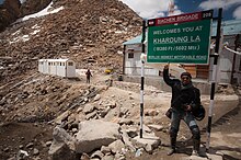
The signs on Khardung La and maps indicate the pass height at 5602 m . Independent measurements with GPS and analog devices from various travelers indicate that the true pass height is around 5359 m . A similar value of 5350 m can also be obtained by analyzing the SRTM data .
Web links
Individual evidence
- ^ DGPS document prepared by the Cartographic Institute of Catalonia
- ↑ Local SRTM data ( Memento of the original from February 21, 2014 in the Internet Archive ) Info: The archive link was automatically inserted and not yet checked. Please check the original and archive link according to the instructions and then remove this notice.
- ↑ Excerpt from a Russian "100K" topographic map ( memento of the original from September 27, 2007 in the Internet Archive ) Info: The archive link was inserted automatically and has not yet been checked. Please check the original and archive link according to the instructions and then remove this notice. . Note: The map shows "Khardung" (in Cyrillic) further east, but the pass is correctly marked.


