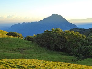
Tapo (mountain)
| Tapo | ||
|---|---|---|
|
The tapo |
||
| height | 1934 m | |
| location | Suco liver , Office of Administration Bobonaro , community Bobonaro , East Timor | |
| Coordinates | 9 ° 5 '10 " S , 125 ° 13' 50" O | |
|
|
||
The Tapo (also Lolo Tapo ) is a mountain in East Timor . At 1934 m, it is the highest mountain in the municipality of Bobonaro . The Tapo is located in the west of the Sucos Leber , near the border with the Suco Tapo .
Web links
Commons : Tapo (mountain) - collection of images, videos and audio files
Individual evidence
- ↑ Ministry of State Administration and Territorial Management: Bobonaro ( Memento of February 16, 2013 in the Internet Archive )
- ^ Timor-Leste GIS-Portal ( Memento from June 30, 2007 in the Internet Archive )


