Tel Sheva
| Tel Sheva | ||
|---|---|---|

|
||
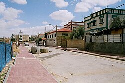
| Street in Tel Sheva | ||
| Basic data | ||
| hebrew : | תל שבע | |
| arabic : | تل السبع | |
| State : |
|
|
| District : | south | |
| Founded : | 1967 | |
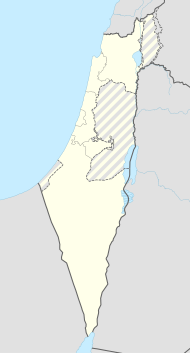
| Coordinates : | 31 ° 15 ' N , 34 ° 51' E | |
| Height : | 312 m | |
| Area : | 5.00 km² | |
| Residents : | 20.204 (as of 2018) | |
| Population density : | 4,041 inhabitants per km² | |
| Community code : | 1054 | |
| Time zone : | UTC + 2 | |
| Community type: | Local association | |
|
|
||
Tel Scheva (Arabic: تل السبع Tal as-Sabaʿ; Hebrew: תל שבע) is a local association in the southern district of Israel .
According to the Israel Central Bureau of Statistics (CBS), Tel Sheva had 20,204 inhabitants in 2018. According to the CBS, the population grew by 3.5% annually. The area of the local association covers 5 km². 4041 people live there in one square kilometer. The average wage of the employees in 2006 was 3411 NIS (national average: 7466 NIS). Only 43% of the twelfth grade students achieve a higher school leaving certificate.
Tel Scheva was founded in 1967 as part of a government project for the permanent settlement of Bedouins . In 1984 it received local association rights.
Individual evidence
- ↑ אוכלוסייה ביישובים 2018 (population of the settlements 2018). (XLSX; 0.13 MB) Israel Central Bureau of Statistics , August 25, 2019, accessed May 11, 2020 .
- ↑ אוכלוסייה ביישובים 2018 (population of the settlements 2018). (XLSX; 0.13 MB) Israel Central Bureau of Statistics , August 25, 2019, accessed May 11, 2020 .
- ^ Israel Ministry of Foreign Affairs: The Bedouin in Israel
