Theodor-Heuss-Strasse (Stuttgart)
| Theodor-Heuss-Strasse | |
|---|---|
| Street in Stuttgart | |
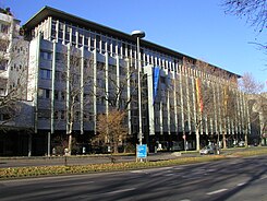
| The Ministry of Economic Affairs on Theodor-Heuss-Straße | |
| Basic data | |
| place | Stuttgart |
| District | center |
| Cross streets | Lange Strasse, Gymnasiumstrasse, Büchsenstrasse, Kienestrasse, Willi-Bleicher-Strasse |
| Places | Rotebühlplatz |
| Buildings | Social Court Stuttgart , Ministry of Economics |
| use | |
| User groups | Road traffic , foot traffic |
| Technical specifications | |
| Street length | 0.6 km |
The Theodor Heuss street in Stuttgart city runs as part of the federal highway 27a between the Rotebühlplatz and Friedrichsbau , where it merges into Friedrichstrasse. It has been named after the first Federal President Theodor Heuss since 1963 , before it was called Rote Straße since the 16th century .
history
The street was built when the Upper Suburb was built under Count Ulrich the Beloved from around 1455. It was first mentioned as Rothe Gasse in 1536 and was known as Rote Straße until after the Second World War . The street was a residential street until the 19th century and only developed into a commercial street in the course of the 20th century.
The street in its current course was only laid out after 1948, but it follows the course of the former Friedrichstrasse and Rote Strasse. The great damage caused by the war gave city planners in 1948 the opportunity to design a boulevard based on the model of Berlin's Kurfürstendamm , although the widening and straightening of the Rote Straße had already begun in 1930 and had been driven away with partly gigantic plans during the time of National Socialism. After the first large area bombing, NS city planners saw the opportunity to widen the Rote Straße to a width of 80 or 90 meters and to let it run towards the Gauforum on Rotebühlplatz . The first post-war plans, however, only envisaged a 55-meter-wide street with seven transverse skyscrapers, but the plans led to protests among the citizens. In 1950, the street width was only estimated at 48 meters in the planning and was finally carried out that way. The street was given its current name in December 1963, a few days after the death of Theodor Heuss, who gave it its name.
Until a few years ago, the street still had the character of a green urban highway. The traffic volume forecast around 1955 when the road was built was not reached in 2002 either, so Theodor-Heuss-Strasse was reduced to two lanes. The sidewalks have been widened on the sides and cycle paths have been created, and there is now a parallel parking lane.
With the redesign, the street turned into a party mile. There are now numerous clubs, lounges and restaurants between Kienestrasse and Rotebühlplatz. The so-called Palace of the Republic is a meeting point at the beginning of Lautenschlagerstraße.
The TREFFPUNKT Rotebühlplatz (adult education center, music school) and the Forum Theater Stuttgart gGmbH can be found on Theodor-Heuss-Straße as cultural institutions . The Friedrichsbau Varieté had to find a new location. On the other hand, police station 1 moved to Theodor-Heuss-Straße 11 in 2016. For various reasons (safety of party-goers, control of car victims ) a speed limit of 30 km / h was set for the night.
The S-Bahn runs under the street, the Stuttgart-Stadtmitte stop has the two exits Büchsenstraße and Rotebühlplatz.
Individual evidence
- ↑ a b c Schukraft 1986, p. 119.
- ^ Erik Raidt: Theodor-Heuss-Strasse. Will the paint be off soon? ( Memento from July 7, 2012 in the web archive archive.today ). Stuttgarter Zeitung, Stuttgart & Region, September 3, 2008.
- ↑ http://www.partys-in-stuttgart.de/location02.htm
- ↑ Paragraph contract for the Palast der Republik extended by 20 years in the article Die Theo is half dead! Long live Theo! , Stuttgarter Zeitung (online)
- ↑ Police move near the STN party mile (2016, online)
literature
- Harald Schukraft: Stuttgarter Straßen-Geschichte (n) , Stuttgart 1986, pp. 118-121.
Coordinates: 48 ° 46 '37 " N , 9 ° 10' 26" E
