
Tizard bank
| Tizard bank | ||
|---|---|---|
 |
||
| Waters | South China Sea | |
| archipelago | Spratly Islands | |
| Geographical location | 10 ° 16 ' N , 114 ° 26' E | |
|
||
| Number of islands | 3 natural islands | |
| Main island | Taiping Dao (Itu Aba) | |
| length | 59.37 km | |
| width | 21.5 km | |
| Land area | 76.5 ha | |
| total area | 953 km² | |
| Highest elevation | 3.8 m | |
| Residents | 200 | |
 |
||

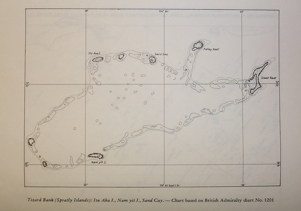
The Tizard Bank , Chinese 郑 和 群 礁 , Pinyin Zhènghé Qúnjiāo , Vietnamese Trịnh Hoà quần tiêu , is a large, partially sunken atoll in the northern area of the Spratly Islands . The western name Tizard Bank is named after the English oceanographer Thomas Henry Tizard (1839-1924).
geography
Neighboring atolls are the Loaita Bank about 30 kilometers north, the Union Banks about 28 kilometers south, and Discovery Great Reef about 40 kilometers west-southwest.
The Tizard Bank has an elongated floor plan with the larger axis from southwest to northeast. It is 59.37 km long and up to 13.5 km wide. The total area is 953 km², and the central lagoon is up to 80 meters deep. However, it has numerous coral stocks with depths of only six to twelve meters, and the seafarer's manual warns of possible even shallower depths.
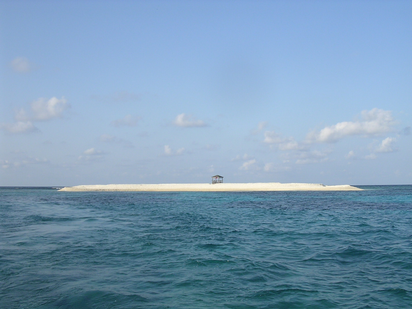
In comparison with the total area of the atoll of 953 km², the land area of the four islands on the reef rim is vanishingly small with a total of 76.5 hectares or just under 0.8 km². In addition to the islands, there are also some reefs that dry out at low tide and some of which are also provided with military facilities.
Large parts of the reef rim have sunk or lie in water depths of six to twelve meters.
The main island is Taiping Dao ( English Itu Aba ) in the north-west of the atoll, which with an area of 46 hectares is also the largest single island in the entire archipelago of the Spratly Islands. Around 600 members of the Republic of China's army and their families are stationed on this island . Other islands are Namyit in the south (5.3 hectares) and Sand Cay in the north (7 hectares). In addition, Zhongzhou Reef or Ban Than Reef between Taiping Dao and Sand Cay with a land area of 0.2 hectares is mentioned. The remaining reefs, including Petley Reef in the northeast and Eldad Reef in the east, have no permanent land area, although they may dry out at low tide.
administration
Individual islands and reefs are occupied by the Republic of China (Taiping Dao and Zhongzhou Reef), Vietnam ( Namyit and Sand Cay ) and the People's Republic of China ( Nanxun Jiao , no natural land area, an 18-hectare artificial island since 2014/2015) all lay claim to the entire atoll and the neighboring Spratly Islands.
The atoll or the part controlled by the Republic of China (Taiping Dao and Zhongzhou Jiao) is, from the perspective of the Republic of China, part of the Qijin district of the city of Kaohsiung .
From a Vietnamese point of view, the islands belong to the Trường Sa district of the Khánh Hòa province .
From the Chinese perspective, the atoll is part of the hypothetical big community Fiery Cross Reef the city Sansha , province Hainan .
List of islands, sandbars and reefs in the Tizard Bank
Below are the islands, sandbars, and reefs of the atoll in clockwise order, starting from the southwest:
![]() Map with all coordinates: OSM | WikiMap
Map with all coordinates: OSM | WikiMap
| No. | Surname | other names | Coordinates | Land area km² |
Controlling State |
|---|---|---|---|---|---|
| 1 | Xiao Nanxun Jiao (小 南薰 礁) | Đá Lạc, Gaven Reef South | 10 ° 9 ′ 45 ″ N , 114 ° 15 ′ 9 ″ E | ? | People's Republic of China? |
| 2 | Nanxun Jiao (南薰 礁) | Đá Ga Ven, Gaven Reef North | 10 ° 12 '26 " N , 114 ° 13' 27" E | 0.18 | People's Republic of China (1988) |
| 3 | Taiping Dao (太平 岛) | Đảo Ba Bình, Ligaw, Itu Aba Island | 10 ° 22 ′ 35 " N , 114 ° 21 ′ 56" E | 0.46 | Republic of China (Taiwan) (1956/1963) |
| 4th | Zhongzhou Jiao (中洲 礁) | Bãi Bàn Than, Zhongzhou Reef, Center Cay | 10 ° 22 ′ 58 " N , 114 ° 24 ′ 43" E | 0.002 | Republic of China (Taiwan) (March 1995) |
| 5 | Đảo Sơn Approx | Dunqian Shazhou (敦 谦 沙洲), Sand Cay | 10 ° 22 ′ 35 " N , 114 ° 28 ′ 48" E | 0.07 | Vietnam (1974/1975) |
| 6th | Đá Núi Thị | Bolan Jiao (舶 兰 礁), Petley Reef | 10 ° 24 '16 " N , 114 ° 34' 58" E | ? | Vietnam (1988) |
| 7th | Anda Jiao (安达 礁) | Đá Én Đất, Eldad Reef | 10 ° 22 ′ 1 ″ N , 114 ° 43 ′ 8 ″ E | ? | People's Republic of China (1978/1983) |
| 8th | Đảo Nam Yết | Hongxiu Dao (鸿 庥 岛), Binago, Namyit Island | 10 ° 10 ′ 44 " N , 114 ° 21 ′ 56" E | 0.053 | Vietnam (1974/1975) |


Individual evidence
- ^ Atoll Area, Depth and Rainfall
- ↑ US NGA : Pub. 161 Sailing Directions (Enroute) South China Sea and the Gulf of Thailand, Fifteenth Edition, 2014 . msi.nga.mil. Pp. 9–10, (Sections 1.24 - 1.26). 15th November 2014.
- ↑ Year numbers according to List of the names of all Spratly features known to be occupied and / or above water at low tide