Tjødnane
| Tjødnane | ||
|---|---|---|

|
||
| Geographical location | Sandnes ( Rogaland , Norway ) | |
| Drain | Lysefjord | |
| Data | ||
| Coordinates | 58 ° 59 '21 " N , 6 ° 10' 23" E | |
|
|
||
| Altitude above sea level | 531 moh. | |
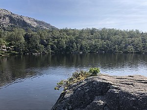
Tjødnane is a group of small lakes in Rogaland Province in Sandnes Municipality in Norway .
The lakes are about one kilometer west of the famous Pulpit Rock . The heavily used hiking trail that leads from the Preikestolhytta mountain hut to the Pulpit Rock runs through the group of lakes.
The largest of the lakes is the westernmost of the group. It covers 4800 m² and has a diameter of about 90 meters. Its catchment area is given as 30,000 m², its altitude as 531.3 meters. Sometimes only this lake is given as Tjødnane. Another lake in the group is about 30 meters further east. Its height is slightly higher at 534.5 meters. It extends in a west-east direction over about 80 meters, with a width of up to 50 meters. A third lake is about 15 meters south of this, at an altitude of about 541 meters. It stretches elongated from southwest to northeast over about 100 meters, with a width of up to about 40 meters. In addition, there are several smaller water areas in the immediate vicinity.
The municipality boundary runs a little to the north between Sandnes and Strand .
Web links
- Tjødnane on norgeskart.no (Norwegian)
- atlas.nve.no (Norwegian)


