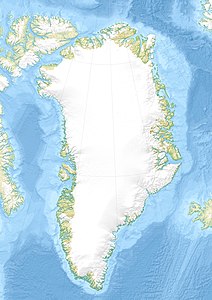
Tobias Island
| Tobias Island | ||
|---|---|---|
| Waters | Greenland Sea | |
| Geographical location | 79 ° 20 ′ 34 ″ N , 15 ° 46 ′ 31 ″ W | |
|
|
||
| length | 2 km | |
| width | 1.5 km | |
| Highest elevation | 35 m | |
| Residents | uninhabited | |
The Tobias Island ( Greenlandic Tuppiap Qeqertaa , Danish Tobias Ø ) is a small uninhabited island in the Greenland Sea .
geography
The island is two kilometers long and 1.5 kilometers wide. It is located about 70 km east of mainland Greenland off the coast of Lambert Land . The flat island consisting of sand and rubble is almost completely covered by an ice cap up to 35 meters high .
history
The name of the island is reminiscent of the Greenlandic hunter and dog sled driver Tobias Gabrielsen (1878–1945), who went on a sled trip with the Danish polar explorer Johan Peter Koch and the painter Aage Bertelsen along the northeast coast of Greenland to Peary Land during the Danmark expedition . On May 2, 1907, the group believed they could see land northeast of Nordostrundingen , which could not be reached due to the difficult ice conditions. Occasional sightings of a mirage land between Greenland and Svalbard were also reported later . However, Lauge Koch was unable to discover the island on his reconnaissance flights over the Greenland Sea in 1938 .
In May 1993, Gereon Budéus from the Alfred Wegener Institute in Bremerhaven discovered an ice cap several hundred kilometers further south, landed on it in the helicopter from the research vessel Polarstern and removed a three-meter-long ice core from it . When Budéus' discovery became known to the Danish authorities in 1998, they tried unsuccessfully to reach the island from Greenland by helicopter. It was not until July 28, 1999 that the Danish glaciologist Ole B. Olesen landed with the Polarstern helicopter . In 2001, Denmark took possession of the island after successfully flying a Twin Otter from Nord Station .
In the negotiations between Denmark / Greenland and Norway that began in 2004 on the maritime border between Greenland and Spitsbergen , Tobias Island was the only difficulty. The agreement reached in 2006 defines the limit of the exclusive economic zones on the center line of the Greenland Sea, taking Tobias Island into account .
flora
The harsh polar climate hardly allows for plant growth. In 2003, the only land plants three moss species detected - the Purpurstielige Horn tooth moss ( Ceratodon purpureus ) Encalypta spatulata and a kind of Birnmoose ( Bryum sp. ).
literature
- Axel Fiedler: About a mirage that became an island . In: Greenland Collector Volume 12, No. 3/2007, p. 5
Individual evidence
- ↑ Ole Bennike, Naja Mikkelsen, Rene Forsberg, Lars Hedenas: Tuppiap Qeqertaa Tobias Island a newly discovered island off northeast Greenland . In: Polar Record Vol. 42, No. 223, 2006, pp. 309-314 ( abstract , English)
- ^ G. Amdrup : Report on the Danmark Expedition to the North-East Coast of Greenland 1906-1908 . In: Meddelelser om Grønland 41, 1913, p. 124 (English)
- ↑ Anthony K. Higgins: Exploration history of northern East Greenland (PDF; 2.9 MB). In: Exploration history and place names of northern East Greenland (= Geological Survey of Denmark and Greenland Bulletin 21, 2010), ISBN 978-87-7871-292-9 . P. 49 (English)
- ↑ a b Ole Bennike, Naja Mikkelsen, Rene Forsberg: Tobias Ø . In: Tidsskriftet Grønland year 57, No. 1/2009, pp. 18-25 (Danish)
- ↑ Bjørn Geirr Harsson, George Preiss: Norwegian Baselines, Maritime Boundaries and the UN Convention on the Law of the Sea (PDF; 1.84 MB). In: Arctic Review on Law and Politics 3, No. 1/2012, pp. 108–129 (English)
- ↑ Michael Byers, James Baker: International Law and the Arctic (PDF; 1.06 MB). Cambridge University Press, 2013, ISBN 978-1-107-04275-9 , p. 38 (English)
