Tortel
| Tortel | ||
|---|---|---|
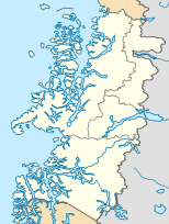
| Location of the municipality in the Aisén region | ||
| Communal data | ||
| region | Aisen | |
| province | Captain Prat | |
| founding | May 28, 1955 | |
| Residents | 507 (2002) | |
| - in cities | 0 | |
| - in the country | 507 | |
| surface | 19,930.6 km² | |
| Population density | 0 inhabitants / km² | |
| Post Code | 6120000 | |
| prefix | + (56-) 67 | |
| Time zone | UTC −4 | |
| Alkalis | Bernardo López Sierra | |
| Website | ||
| main place | ||
|
Caleta Tortel on the map of Chile |
||
| Surname | Caleta tortel | |
| status | Aldea | |
| Residents | 320 (2002) | |
Tortel is the southernmost municipality in the Chilean Región de Aisén (Region XI). A total of around 500 people live here.
geography
Caleta Tortel is 462 km southwest of Coyhaique . The climate is due to the southern location already quite polar , winter temperatures drop to -20 ° C.
history
In 1899 the German geographer Hans Steffen explored West Patagonia . The Italian Catholic Father Antonio Ronchi built many small churches in the area over about 30 years.
economy
The place is a bit off the Carretera Austral, which has to use a small ferry connection over the Río Bravo and the Mitchell Fjord. Fishing and tourism play a role.
tourism
The Río Baker and Río Bravo are popular fishing areas. In the northwest lies the Laguna San Rafael National Park with its glaciers . There is also the port of Caleta Tortel, which has a small airport. In the south lies the huge Bernardo O'Higgins National Park .


