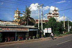
Trảng Bàng
| Trảng Bàng | ||
|---|---|---|
|
|
||
| Basic data | ||
| Country: |
|
|
| Region : | Đông Nam Bộ | |
| Province : | Tây Ninh | |
| ISO 3166-2: VN : | VN-37 | |
| Coordinates : | 11 ° 2 ′ N , 106 ° 22 ′ E | |
| Further information | ||
| Time zone : | UTC +7: 00 | |
Trảng Bàng is a village in Tây Ninh Province in Vietnam .
location
Trảng Bàng is located around 25 km northwest of Ho Chi Minh City . National roads 6, 22, 782, 787 and 825 cross in the city.
history
During the Vietnam War on June 8, 1972, the South Vietnamese army - equipped with US- made Skyraiders - dropped napalm bombs over the village. The result was the picture of Phan Thi Kim Phuc running out of the burning village and screaming in pain, photographed by Nick Út (see The Terror of War ).
economy
The city has several large industrial areas.
sons and daughters of the town
- Phan Thị Kim Phúc , O.Ont (* 1963), victim of the Vietnam War
Others
There is also a famous food called Banh Canh Trang Bang, a bread soup made with rice flour bread, meat, fish, seafood, and vegetables.
Individual evidence
- ^ Neer, Robert M .: Napalm. An American Biography, Cambridge (Mass.) Et al. 2013, pp. 1–4
- ↑ Tây Ninh Industrial Zones Authority ( Memento of the original from October 16, 2011 in the Internet Archive ) Info: The archive link was automatically inserted and not yet checked. Please check the original and archive link according to the instructions and then remove this notice.

