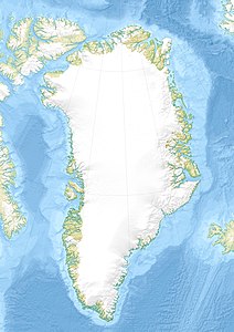
Trail (island)
| Trail | ||
|---|---|---|
| Satellite image of the island of Traill | ||
| Waters | Greenland Sea | |
| Geographical location | 72 ° 35 ′ N , 23 ° 18 ′ W | |
|
|
||
| length | 110 km | |
| width | 48 km | |
| surface | 3 541.6 km² | |
| Highest elevation | (unnamed) 1884 m |
|
| Residents | uninhabited | |
Traill ( Danish: Traill Ø ) is the fourth largest island in Greenland with an area of almost 3542 km² and, after Milneland, the second largest island off the east coast of this autonomous nation. Administratively, it belonged to the province of Tunu ("East Greenland") until the end of 2008 , and since 2009 to the non-parish area of the Northeast Greenland National Park .
The island is named after the Scottish legal scholar and zoologist Thomas Stewart Traill (1781–1862), who determined numerous animals that William Scoresby brought back from his research trips from the Arctic .
geography
Traill is located off the east coast of Greenland in the Greenland Sea . In the west and south-west, the King Oskar Fjord separates the island from Scoresbyland , and in the north the Vegasund from the Geographical Society Ø . To the east, Mountnorris Fjord cuts 25 km deep into the rugged island. Traill is about 110 km long and up to 48 km wide. Its highest point is given as 1,884 meters above sea level.
See also
Individual evidence
- ↑ UNEP Islands (English)
- ↑ Trail Ø . In: Anthony K. Higgins: Exploration history and place names of northern East Greenland. (= Geological Survey of Denmark and Greenland Bulletin 21, 2010). Copenhagen 2010, ISBN 978-87-7871-292-9 (English), accessed December 28, 2013
- ↑ Traill High Point on Peakbagger.com (English)


