Trysunda
| Trysunda | ||
|---|---|---|
| The main town on Trysunda, in the background the mooring M / F Ulvön . | ||
| Waters | Gulf of Bothnia | |
| Geographical location | 63 ° 8 '24 " N , 18 ° 47' 39" E | |
|
|
||
| length | 2.8 km | |
| width | 1.4 km | |
| Highest elevation | Kapellsberget 85 m above sea level |
|
| Residents | 2 | |
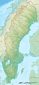
Trysunda is an island in the archipelago of the Swedish municipality of Örnsköldsvik . In the days of the Gävle fishermen , Trysunda was the last fishing village to which long-distance trips were made.
Trysunda is about eight kilometers north of the island of Ulvön and the same distance from Köpmanholmen on the mainland. The island consists of a mixture of reddish granite , gray sandstone and dark diabase . Through this there is a species-rich vegetation with plants such as cushion saxifrage , real moon rue and alpine light carnation . Trysunda and several small islands in the area are a nature reserve and Natura 2000 area, including sea eagles .
Apart from the main town, there are no buildings on the island. The sheltered village was founded by fishermen from the central Swedish town of Gävle , who sailed north every summer and fished there. When the fishing trips began, today's island consisted of three smaller islands that later grew together due to the post-glacial uplift . The Gävlefischer built a simple chapel in 1654, which was originally decorated with paintings similar to the Ulvö gamla chapel . Long-distance journeys ended in the 19th century, Erik August Grellson was the last fisherman to sail from Gävle to Trysunda every year until 1899. The village has been used by local fishermen for a long time.
In the east of the island there are thin layers of iron ore in the diabase rock , which also contains titanium and vanadium in small quantities . At the end of the 19th and beginning of the 20th century, small amounts of the ore were mined, which were exported to the German Empire during the First and Second World Wars . From the work, notches can be seen in the mountain, next to it are a compressor and a locomobile .
The old fishermen's houses are now used as holiday homes , only one couple lives on the island all year round. In summer, ferries run several times a day from Köpmanholmen to Trysunda, which has one of the few sandy beaches in Örnsköldsvik municipality. In the course of the increasing number of visitors, a new pier for pleasure boats and an island museum were built in 2013 .
Web links
literature
- Per Vedin: Det forntida fisket vid norrlandskusten: Gävlebohamnar under gångna århundraden. Skolförlaget, Gävle 1930.
Individual evidence
- ↑ Trysunda. lansstyrelsen.se, accessed October 3, 2013 (Swedish).
- ↑ a b Trysunda - världsarvets pärla. (PDF; 705 kB) lansstyrelsen.se, accessed on October 3, 2013 (Swedish).
- ↑ Per Vedin: Det forntida fisket vid norrlandskusten: Gävlebohamnar under gångna århundraden. 1930, p. 114.
- ↑ Gruvmaskin Trysunda. murberget.se, accessed October 3, 2013 (Swedish).
- ↑ Nya Trysunda växer fram. allehanda.se, accessed October 3, 2013 (Swedish).

