Tshabong

from Wikipedia, the free encyclopedia
Tshabong
Tshabong (Botswana)
Red pog.svg
Coordinates 26 ° 1 ′  S , 22 ° 24 ′  E Coordinates: 26 ° 1 ′  S , 22 ° 24 ′  E
Basic data
Country Botswana

District

Kgalagadi District
height 969 m
Residents 9471 (2011)
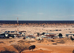
View of Tshabong
View of Tshabong

Tshabong (alternative spelling: Tsabong ) is the administrative center of the Kgalagadi district in Botswana . The place is in the Kalahari . In 2011, according to the census, 9,471 people lived in Tshabong. Tshabong is located at an altitude of 969 meters.

The place can be reached by plane via Tshabong Airport, which is around 2.2 kilometers away.

Climate table

Average monthly temperatures and rainfall for Tshabong
Jan Feb Mar Apr May Jun Jul Aug Sep Oct Nov Dec
Max. Temperature ( ° C ) 35.1 33.6 31.5 28.2 24.6 21.3 21.8 24.7 28.6 31.3 33.1 34.2 O 29
Min. Temperature (° C) 18.7 18.2 16.1 11.2 5.7 1.8 1.0 3.1 7.6 12.2 15.9 17.6 O 10.7
Precipitation ( mm ) 32 46 42 31 15th 9 1 0 7th 10 24 33 Σ 250
Hours of sunshine ( h / d ) 10.7 10.2 10.1 9.6 9.5 9.7 9.7 10.7 10.7 11.1 11.1 10.7 O 10.3
Rainy days ( d ) 4th 5 5 3 2 1 0 0 1 2 3 4th Σ 30th
Humidity ( % ) 40 46 50 53 54 53 47 37 31 30th 35 36 O 42.6
T
e
m
p
e
r
a
t
u
r
35.1
18.7
33.6
18.2
31.5
16.1
28.2
11.2
24.6
5.7
21.3
1.8
21.8
1.0
24.7
3.1
28.6
7.6
31.3
12.2
33.1
15.9
34.2
17.6
Jan Feb Mar Apr May Jun Jul Aug Sep Oct Nov Dec
N
i
e
d
e
r
s
c
h
l
a
g
32
46
42
31
15th
9
1
0
7th
10
24
33
  Jan Feb Mar Apr May Jun Jul Aug Sep Oct Nov Dec
Source: wetterkontor.de

Individual evidence

  1. ^ Population and Housing Census 2011 - Selected Indicators Kgalagadi South Sub District
  2. Tiptopglobe: City (town): Tsabong: map, population, location
  3. Google Maps: Distance Tshabong - Tshabong Airport