Tunapuna
| Tunapuna | ||
|---|---|---|
|
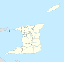
Coordinates: 10 ° 38 ′ N , 61 ° 23 ′ W Tunapuna on the map of Trinidad and Tobago
|
||
| Basic data | ||
| Country | Trinidad and Tobago | |
| region | Tunapuna-Piarco | |
| Residents | 17,650 (2012) | |
| Detailed data | ||
| Waters | Tunapuna River | |
| Time zone | UTC −4 | |
| Tunapuna, in the background Trincity | ||
Tunapuna is a city in Trinidad and Tobago . It is the capital of the Tunapuna-Piarco region .
location
Tunapuna is located in the north of the island of Trinidad , in the middle of the East-West Corridor , the metropolitan region of the state capital Port of Spain south of the Northern Range from west to east . Since Port of Spain is bounded in the north by the Northen Range and in the south by the Caroni Swamp , the city expanded to the east over time. The resulting east-west corridor is so densely populated that in the past independent cities merge into one another and now have the character of districts of the capital agglomeration. However, they are still formally independent. Tunapuna goes counter-clockwise and starts in the west over to St. Augustine , Curepe , Macoya, Trincity and El Dorado.
The Tunapuna River rises in Tunapuna and runs to the southwest, where it drains into the Caroni River near Bamboo Village .
history
The name "Tunapuna" is of Indian origin and means "by the river". During the British colonial era, large parts of what is now the urban area of plantations were owned by the Auzonville and Bootsman families. After the cocoa and coffee boom subsided, the land was gradually sold as a settlement area; part was donated to the settlement administration and today forms the 12 hectare Auzonville Park. In 1898 Tunapuna received city rights. In 1907 a Salvation Army corps was established. In 1912 the Benedictine monk Dom Mayeul de Caigny founded the Mount St. Benedict Monastery , the oldest monastery in the Caribbean, near Tunapuna . In 1947 the church of the monastery was elevated to the status of an abbey church.
economy
Tunapuna consists mostly of residential areas. Industry has settled along the Churchill Roosevelt Highway , the most important east-west route in Trinidad. There are companies in the food and light industry for local needs and for supplying the neighboring islands. One of the larger employers is Caribbean Bottlers Ltd., a bottler for Coca-Cola in Trinidad and Tobago. The service sector is characterized by financial service providers such as banks, insurance companies and many wholesalers and retailers. Tunapuna has an important market and is a trading center for the surrounding area.
Facilities
To the southwest, Tunapuna is adjacent to the campus of the Trinidian branch of the University of the West Indies , which u. a. houses the world's first research center for tropical agriculture.
As of 2002, 15 steel bands had their headquarters in Tunapuna.
The Joe Public FC plays in the highest soccer league in the country, the TT Pro League. The club from Tunapuna is owned by Jack Warner .
Personalities
- Winifred Atwell (1914–1983, pianist)
- CLR James (1901-1989, writer)
- Tyrell Johnson (1917–1985, cricketer)
- Darin Lewis (* 1976, soccer player)
- Lakshmi Persaud (* 1939, writer)
gallery
Individual evidence
- ↑ Gov.tt: Tunapuna to benefit from newly refurbished community center ( Memento from March 4, 2016 in the Internet Archive )
- ^ Caribbean History Archive
- ^ Caribbean History Archive
- ↑ Data sheet Tunapuna


