Tyra (Olsa)
|
Tyra Tyrka |
||
|
The Tyra at Tyra |
||
| Data | ||
| location | Moravskoslezský kraj , Czech Republic | |
| River system | Or | |
| Drain over | Olsa → Or → Stettiner Haff | |
| source | Northern slope of Kalužný in the Moravian-Silesian Beskids 49 ° 34 ′ 57 ″ N , 18 ° 37 ′ 51 ″ E |
|
| Source height | 835 m nm | |
| muzzle | at Třinec in the Olsa coordinates: 49 ° 40 ′ 59 " N , 18 ° 39 ′ 23" E 49 ° 40 ′ 59 " N , 18 ° 39 ′ 23" E |
|
| Mouth height | 305 m nm | |
| Height difference | 530 m | |
| Bottom slope | 40 ‰ | |
| length | 13.1 km | |
| Catchment area | 31 km² | |
| Drain |
MQ |
600 l / s |
| Residents in the catchment area | 3218 | |
The Tyra , also Tyrka , is a left tributary of the Olsa in the Czech Republic .
course
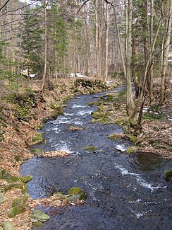
The Tyra rises on the northern slope of Kalužný (993 m) in the Moravian-Silesian Beskids . At its predominantly to the north, z. The settlements of Biernač, Do Lodra, Tyra and Podgrúň lie partly to the northeast, in a deep wooded valley through the mountains . There the river reaches the Beskid foothills and flows over Oldřichovice , Závist and Canada after 13.1 kilometers opposite the Třinec steelworks into the Olsa.
Tributaries
- Tyrka (l), Závist
- Javorový potok (l), Závist
- Canada, (l), Canada
