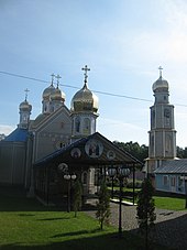
Tyssowez (Storoschynez)
| Tyssowez (Storoschynez) | ||
| Тисовець | ||

|
|
|
| Basic data | ||
|---|---|---|
| Oblast : | Chernivtsi Oblast | |
| Rajon : | Storozhynets district | |
| Height : | 274 m | |
| Area : | Information is missing | |
| Residents : | 3,556 (2004) | |
| Postcodes : | 59054 | |
| Area code : | +380 3735 | |
| Geographic location : | 48 ° 10 ' N , 25 ° 54' E | |
| KOATUU : | 7324589701 | |
| Administrative structure : | 1 village | |
| Address: | 59054 с. Тисовець | |
| Website : | https://rada.info/rada/04524970/ | |
| Statistical information | ||
|
|
||
Tyssowez ( Ukrainian Тисовець ; Russian Тисовец Tissowez , Romanian Tişăuţi , German (until 1918) Tysowec ) is a village in the center of the Ukrainian Oblast Chernivtsi with about 3500 inhabitants (2004).
Tysovets was an independent municipality until 2015 and since then has belonged to the district council of the neighboring village of Velykyj Kuchuriv in the east of Storozhynets district .
The village is located on the left bank of the Derehluj ( Дереглуй ), a 34 km long tributary of the Prut , 19 km east of the district center of Storoschynez and 15 km south of the oblast capital Chernivtsi .
Tyssowez has a train station on the Chernivtsi – Suceava line . Territorial road T-26-05 runs through the village .
Individual evidence
- ↑ local website Tyssowez on the official website of the Verkhovna Rada ; accessed on October 1, 2017 (Ukrainian)
- ^ Official website of the Verkhovna Rada ; accessed on October 1, 2017 (Ukrainian)


