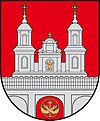
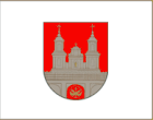
Tytuvėnai
| Tytuvėnai | |||
|
|||
| State : |
|
||
| District : | Šiauliai | ||
| Rajong municipality : | Kelmė | ||
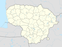
| Coordinates : | 55 ° 36 ′ N , 23 ° 12 ′ E | ||
| Height : | 130 m | ||
| Inhabitants (place) : | 2,302 (2011) | ||
| Time zone : | EET (UTC + 2) | ||
| Telephone code : | (+370) 427 | ||
| Postal code : | 86477 | ||
| Status: | own city office in Rajongemeinde |
||
| Website : | |||
|
|
|||
Tytuvėnai is a small town in Lithuania . It has the status of a city office ( miesto seniūnija ) in the district of Kelmė in the region of Lower Lithuania . The place is located between the Bridvaišis and Gilius lakes and has about 2,300 inhabitants.
history
The place was first mentioned in the 14th century, the name derives from the river Tytuva. A St. Bernard monastery was founded in Tytuvėnai in the 17th century . The architectural ensemble is well preserved to this day, but is no longer used as a monastery. In 1959, Tytuvėnai Agricultural Technical Center was established.
In Tytuvėnai, a heliport was built especially for Pope John Paul II's visit to Šiluva in 1993 and the road to Šiluva was paved.
During its membership in the Soviet Union , Tytuvėnai was a center of industrial peat extraction . Most of the moors in the area have been destroyed and have not yet been renatured, although they are integrated into the Tytuvėnai Regional Park . In recent times, tourism has been of economic importance.
Personalities
- Jonas Jagminas (* 1949), politician
Web links
- Tytuvėnai Regional Park homepage (Lithuanian), map only works with IE
- Articles on the monastery (Lithuanian)
Individual evidence
- ↑ 2011 census. Statistics Departamentas (Lithuania), accessed on August 3, 2017 .
- ↑ A. Vanagas. Lietuvos miestų vardai . Vilnius 1996.


