Tzum (Friesland)
 flag |
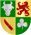
 coat of arms |
| province |
|
| local community |
|
|
Area - land - water |
14.16 km 2 14.07 km 2 0.09 km 2 |
| Residents | 1,140 (Jan. 1, 2017) |
| Coordinates | 53 ° 9 ' N , 5 ° 34' E |
| prefix | 0517 |
| Postcodes | 8732, 8801-8802, 8804-8806, 8823, 8842-8843 |
| Website | Homepage of Tzum |
| Tzum in May 2009 | |
Tzum ( West Frisian Tsjom ) is a West Frisian village in the Netherlands with 1,140 inhabitants (as of January 1, 2017), four kilometers southeast of Franeker , today part of the municipality of Waadhoeke (until 2017 Franekeradeel ). The village is located on a settlement hill ( terp ) that has been heaped up to protect against storm surges . At 72 meters, the church tower is the highest of all village churches in Friesland .
Personalities
- Reinier van Tzum (circa 1600–1670), merchant in the service of the Dutch East India Company , mayor of IJlst .
Web links
Commons : Tzum - collection of images, videos and audio files
- Website of the village (Dutch)
Individual evidence
- ↑ a b Kerncijfers wijken en buurten 2017 Centraal Bureau voor de Statistiek , accessed on June 22, 2018 (Dutch)
