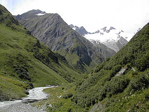
Umbaltal

The Umbaltal is the rear section of the Virgental in East Tyrol . The Hinterbichl district is seen as the beginning of the Umbal Valley.
The upper reaches of the Isel have their origins at the very back of the Umbal Valley as the Umbalbach coming from the Umbalkees . The entire area lies within the Hohe Tauern National Park .
Only a short section in the front part of the valley as far as Hinterbichl- Ströden can be used publicly with motor vehicles . In the front part of the valley, the Islitzer Alm and the Pebellalm, the well-known Umbal Falls and in the rear part the Clarahütte (Alpine Club hut at 2035 m above sea level) and the Kleine-Philipp-Reuter-Bivouac are worth mentioning . The Rötspitze ( 3495 m ) forms the striking visual conclusion at the end of the valley .
Web links
Coordinates: 47 ° 1 ' N , 12 ° 15' E
