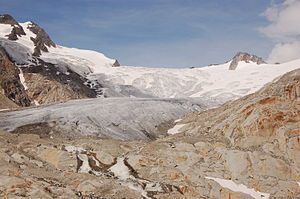
Umbalkees
| Umbalkees | ||
|---|---|---|
|
Umbalkees (2009) |
||
| location | Tyrol , Austria | |
| Mountains | Hohe Tauern | |
| Type | Valley glacier | |
| length | 5 km | |
| surface | 4.52 km² (1998) | |
| Exposure | southwest | |
| Altitude range | 3425 m above sea level A. - 2400 m above sea level A. | |
| Tilt | ⌀ 19.8 ° (36%) | |
| Ice thickness | Max. 120 m | |
| Coordinates | 47 ° 3 '23 " N , 12 ° 14' 28" E | |
|
|
||
| drainage | Isel → Drau → Danube | |
The Umbalkees is a glacier in the Venediger group of the Hohe Tauern in East Tyrol .
location
The Umbalkees extends below the Dreiherrnspitze ( 3499 m above sea level ), Hinterer Gubachspitze ( 3387 m above sea level ) and Vorderer Gubachspitze ( 3316 m above sea level ) at an altitude of around 3425 to 2400 m. The valley glacier flows around 5 km from the main Alpine ridge into the Umbal Valley and feeds the Isel . The Simonykees connects to the east and the Krimmler Kees to the north of the ridge on the Salzburg side . The Umbalkees lies entirely in the Hohe Tauern National Park .
Data
In 1998 the glacier had an area of 4.52 km². The slope is relatively small and averages 19.8 °. Smaller steep steps can be found just above the transition area from the nutrient to the consumption area and in the edge area of the Althauskees (the northern part of the Umbalkee). The greatest ice thickness was measured at 120 m at 2550 m above sea level below the Gubachaspitzen. The tongue was between 40 and 100 m thick, in most of the firn area the ice thickness is rather small.
decline
Like most glaciers in the Alps, the Umbalkees has been affected by glacier melt since the middle of the 19th century . At the beginning of the 1870s, the Umbalkees reached down to around 2300 m above sea level . In the years 1989/90 to 2010/11 alone, the glacier retreated a further 543 m. The Umbalkees is the East Tyrolean glacier that has receded the most. This is due in particular to the orientation to the south or southwest, which means that the glacier is heavily illuminated by the sun throughout the day.
Accidents
A Junkers Ju 52 of the German Wehrmacht had to make an emergency landing on January 4, 1941 at an altitude of 3200 m on the glacier. Ten out of eleven men of the crew survived the landing and laboriously descended into the valley to Prägraten in several days . A rescue team of the German Air Force stationed in Carinthia hurriedly recovered six boxes of the cargo without taking care of the crew, which led to speculation about a secret mission. In 2001 the aircraft wreck was discovered in the ice at an altitude of 2,650 m , which has been gradually recovered since 2003.
On April 1, 2004, the Austrian civil engineer and university professor Gerhard Pichler had an accident on the occasion of a glacier survey on the Umbalkees when he fell into a crevasse covered by a snowdrift and could only be recovered dead.
Web links
Individual evidence
- ^ World Glacier Monitoring Service (WGMS): Fluctuations of Glaciers 2005–2010 (Vol. X). Zurich 2012, p. 120 ( PDF; 5 MB ( Memento of the original from March 5, 2014 in the Internet Archive ) Info: The archive link has been inserted automatically and has not yet been checked. Please check the original and archive link according to the instructions and then remove this notice. )
- ↑ a b c d e f g Hohe Tauern National Park: Umbalkees glacier profile (PDF; 22.8 MB)
- ^ Tyrolean spatial information system : Franzisco-Josephinische Landesaufnahme , data status 1870/73
- ↑ Josef Hilgartner: The "Tante Ju" from Umbalkees. In: Osttirol-Journal, December 9, 2013, p. 13 ( PDF; 1.6 MB )
- ↑ Obituary notice

