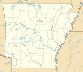
United States Highway 61 Arch
| United States Highway 61 Arch | ||
|---|---|---|
| National Register of Historic Places | ||
|
|
||
| location | ||
| Coordinates | 35 ° 59 '58 " N , 89 ° 53' 54" W | |
| NRHP number | 01001177 | |
| The NRHP added | October 28, 2001 | |
The United States Highway 61 Arch is a listed concrete arch over US Highway 61 on the border between the American states of Missouri and Arkansas .
history
By the late 1910s, the number of cars had also increased sharply in rural areas of the United States. This went hand in hand with the need for better roads. In rural areas in particular, the roads were largely unpaved. To improve traffic conditions, the Federal Aid Act of 1916 provided the states with money for road construction measures for the first time. In return, the states were obliged to plan trunk road networks. Appropriate building districts soon formed.
In Mississippi County , Arkansas, Mississippi County Road Improvement District was No. 1 formed. The district chairman was the entrepreneur Robert E. Lee Wilson . The most important road through the county was the connection between St. Louis and Memphis, known as the North-South Road . However, the road was in very poor condition, so 15 miles took a full day to travel. The street district therefore raised money from taxes, bonds, and subsidies from the Federal Aid Highway Act of 1921 to build the street. In 1924 the 76 kilometer long road through the county was paved and concreted. At that time, about 720 kilometers of road across Arkansas were paved. Associated with the funding from the Federal Aid Road Act was its inclusion in the US highway system. The addition made North-South Road part of Highway 61.
To commemorate the completion of the road, a concrete arch was built on the northern Missouri border and the southern Crittenden County border . The road was the county's first paved road and was viewed with some pride by the county's residents.
The southern concrete arch was removed during road works in the 1950s.
The 1938 begin planning the road in the 1950s was part of the Great River Road - Parkways . With the construction of the largely parallel Interstate 55 highway, the highway lost its importance.
This loss of importance saved the arch, which would inevitably have fallen victim to an expansion of the road. Maintenance is provided by the Arkansas Highway and Transportation Department.
Building
The concrete arch has a square cross-section. It is 4.6 meters high and 6.10 meters wide. The foundations are each 0.4 m². The bow has decorative grooves on each side for decoration. Above the opening are the words ENTERING MISSOURI and ENTERING ARKANSAS.
The arch opening is as wide as the street. Widening is therefore not possible without destroying the arch.
On the arch is a bronze plate with the following content on the ground plan of Arkansas:
1924
FAP No.100
RID No. 1 Mississippi Co.
- ----
Directors
RE Lee Wilson President
RC Rose Secretary
WM Taylor
- ----
G. Hunter Sykes Chief Engineer
HR Wilson State Highway Commissioner
RC Limerick State Highway Engineer
- ----
Contractor
HH Hall Construction Co.
- ----
Materials
Fischer Lime & Cement Co.
The arch was built by HH Hall Construction Co., which was also responsible for building the road.
location
The arch is approximately 8 kilometers north of Blytheville and 11 kilometers southwest of Steele. The road, which otherwise runs from north to south, runs at this point for a length of around 800 meters exactly on the border between the two states in an east-west direction.
Due to this geographical peculiarity and the fact that there were lower taxes on gasoline and cigarettes in Missouri, eleven gas stations were at times built on this section of the road. There were also night clubs and arcades. The area around the arch was therefore given the name "Little Chicago" in the area. The construction of the interstate and the associated loss of traffic caused all shops to close by 1989.
literature
- Robert Thompson: "An arch in time"; The Delta historical review, Vol. 1, No. 2, pp. 51-53
- Registration form. In: National Register of Historical Places. Retrieved August 21, 2018 .
Web links
- United States Highway 61 Arch. In: Arkansas Preservation. Retrieved August 21, 2018 (American English).

