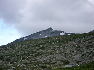
Valbellar maple
| Valbellar maple | ||
|---|---|---|
| height | 2763 m above sea level M. | |
| location | Canton of Graubünden , Switzerland | |
| Mountains | Plessur Alps | |
| Coordinates | 772 931 / 178 996 | |
|
|
||
| First ascent | 1901 by Henry Hoek | |
The Valbellahorn is 2763 m above sea level. M. high summit of the Strela chain in the plural Alps in the Swiss canton of Graubünden .
description
The Valbellahorn is located between the peaks of the Strel ( 2672 m above sea level ) and the Sandhubel ( 2763 m above sea level ). Towards the northwest, the summit drops steeply to the high plateau of the Altein Tiefenberg, in the northeast lies the Altein with the Alteingrat . In the south lies the Davos parliamentary community of Wiesen . The municipal boundary of Davos and Arosa runs on the summit ridge . The Valbellahorn consists largely of Wetterstein dolomite , which rests on alpine shell limestone and Rauhwacke from the older Triassic as well as on the Verrucano , which comes from the Sandhubel . The summit can be climbed from Wiesen, Glaris, or Arosa.
Individual evidence
- ↑ Valbellahorn in the Geographical Lexicon of Switzerland, accessed on April 9, 2018.
- ↑ Swisstopo Valbellahorn accessed on April 9, 2018.

