Velebit Canal
| Velebit Canal | ||
|---|---|---|
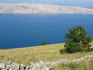
| View from the mainland over the Velebit Channel to the island of Krk | ||
| Connects waters | Kvarner Bay | |
| with water | Kvarner Bay | |
| Separates land mass | Krk , Rab and Pag | |
| of land mass | Balkan Peninsula | |
| Data | ||
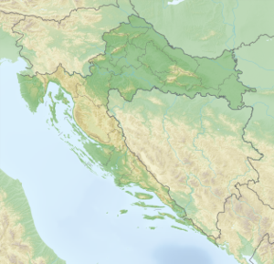
| Geographical location | 44 ° 35 ' N , 14 ° 58' E | |
|
|
||
| length | 130 km | |
| Coastal towns | Crikvenica , Starigrad | |
| bridges | Krk bridge | |
The Velebit Canal ( Croatian Velebitski Canal ) is a strait in the upper Adriatic between mainland Croatia and the offshore islands.
In a broader sense, the strait belongs to the waters of the Kvarner Bay and separates the islands of Krk , Rab and Pag from the Croatian mainland, where the Velebit Mountains rise. Overall, the canal stretches over a distance of around 130 kilometers from Crikvenica to Starigrad (both cities are on the mainland). The width of the canal varies from a few hundred meters to ten kilometers.
The Velebit Canal is one of the most dangerous waters in the Mediterranean area due to the frequent Bora winds , combined with a local jet effect through the Velebit Mountains. In winter, peak wind speeds of up to 240 km / h were measured here in places .
The northernmost section of the waterway between the island of Krk and the mainland is known as the Vinodol Canal . At the narrowest point it is spanned by the Krk Bridge . Further south there are only ferry connections between the mainland and the islands via the canal.
Individual evidence
- ^ Delius Klasing Verlag, Boats magazine: Croatia: Insel Pag , accessed on October 14, 2014

