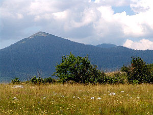
Veliki Šator
| Veliki Šator | ||
|---|---|---|
|
The Veliki Šator |
||
| height | 1872 m. i. J. | |
| location | Bosnia and Herzegovina | |
| Mountains | Dinaric mountains | |
| Coordinates | 44 ° 10 ′ 16 ″ N , 16 ° 37 ′ 16 ″ E | |
|
|
||
The Veliki Šator is at 1872 m or 1875 m the highest elevation of the mountain range Šator (with the German meaning tent) in the north-west of Bosnia and Herzegovina . The mountain range, a part of the Dinaric Mountains , to which the eastern Mali Šator ( 1768 m ) belongs, extends between the Polje of Livno in the south and Drvar in the north, and forms part of a larger mountain range with the Jadovnik , Marino mountain ranges brdo , Staretina and Velika Golija , which in the Velika Golija (Veliki Vrh) reaches an altitude of 1890 m .
flora
The five main peaks of the Šator tower over a densely forested plateau with beech , fir and spruce trees from 1,500 to 1,600 m. The southern slopes of the mountain range are covered by meadows and in summer are rich in flower vegetation. In the past they served as pasture for cattle.
tourism
The promising mountain, which is snow-capped from November to May, is accessed via a road that leads over a distance of 17 km from Gornje Peulje on the connecting road from Bosansko Grahovo to Livno to Lake Šatorsko jezero ( 1488 m ). This lake is of glacial origin, 250 m long, 120 m wide and 6 m deep. There is a small private lodging house by the lake. Various easy climbs lead from the lake to the summit.

