Pre-closure Forchheim
| Pre-closure Forchheim | |||||||||
|---|---|---|---|---|---|---|---|---|---|
|
|||||||||
|
|
|||||||||
| Coordinates | 50 ° 43 '43 " N , 13 ° 16' 41" E | ||||||||
| Data on the structure | |||||||||
| Construction time: | 1972-1976 | ||||||||
| Height above valley floor: | 15.5 m | ||||||||
| Height above foundation level : | 18.5 m | ||||||||
| Height of the structure crown: | 470 m | ||||||||
| Building volume: | 80 000 m³ | ||||||||
| Crown length: | 193 m | ||||||||
| Crown width: | 4 m | ||||||||
| Slope slope on the air side : | 1: 1: 2/1: 2.16 / 1: 2.5 | ||||||||
| Slope slope on the water side : | 1: 1: 2.5 | ||||||||
| Data on the reservoir | |||||||||
| Altitude (at congestion destination ) | 468 m | ||||||||
| Water surface | 12 ha | ||||||||
| Storage space | 0.588 million m³ | ||||||||
| Catchment area | 22.2 km² | ||||||||
| Bridge to the extraction tower with overflow | |||||||||
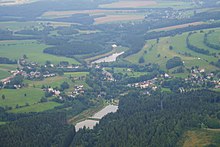
The Forchheim reservoir is a reservoir above the Saidenbach drinking water reservoir in Saxony . It serves this dam for the primary clarification and elimination of pollutants. Although it is a pre- dam, it has the dimensions of a large dam. The Haselbach is dammed .
description
The barrier structure is a two-zone dam with a clay seal on the water side . There is a removal tower in the storage space , which also acts as a flood relief . The lock has been rebuilt several times, including 1982.
The dam has an underwater dam in the area of the reservoir root. This prevents the risk of eutrophication due to nutrients from agriculture and municipal wastewater. When the water is scarce, the dam wall is not covered by water on the air side, so that a pond is created in front of the dam.


