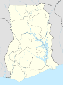
Wa (Ghana)
Coordinates: 10 ° 3 ′ N , 2 ° 30 ′ W
Wa is the capital of the Upper West Region of Ghana and the Wa Municipal District . At the same time it is the city where the Wala people have their ancestral home . The town's name Wa in the language of the Wala the importance Come here . In 2010, 71,051 people lived in the city.
Wa is close to Burkina Faso in the wider border area and is about 150 km from Tamale , the so-called capital of the entire north. A majority of the population of Muslim faith lives in Wa , so Wa is the only larger city in Ghana with a Muslim majority. Wa was founded on an important trade route from the Sahel to the coast. This trade route also brought the Muslim faith to Ghana from the north. Around the 17th century, a large part of the population already professed Islam . To this day, Wa is a Muslim center in Ghana.
The city is home to a mosque in the West Sudanese architectural style. This mosque attracts believers from far away and is one of the highlights of the city. In addition, Wa is the residence city of Wa Naa , the king of the Wala . There is therefore also a large royal palace in the city, which consists of many smaller buildings and is closed off with a wall lined with white battlements . The palace was built in the traditional clay construction around the middle of the 19th century. In front of the palace are tombs of the Wa Naa reign, which is unusually long for Ghana.
Population development
The following overview shows the population by area since the 1970 census.
| year | Residents |
|---|---|
| 1970 | 13,740 |
| 1984 | 36,067 |
| 2000 | 66,644 |
| 2010 | 71.051 |
education
Town twinning
- Ypres (Belgium)
Individual evidence
- ↑ a b Ghana: Regions & Cities - Population Statistics, Maps, Graphics, Weather and Web Information. Retrieved January 6, 2019 .
